
EXHIBITION: Re-Making Maps of the Mind: Medieval and Modern Journeys
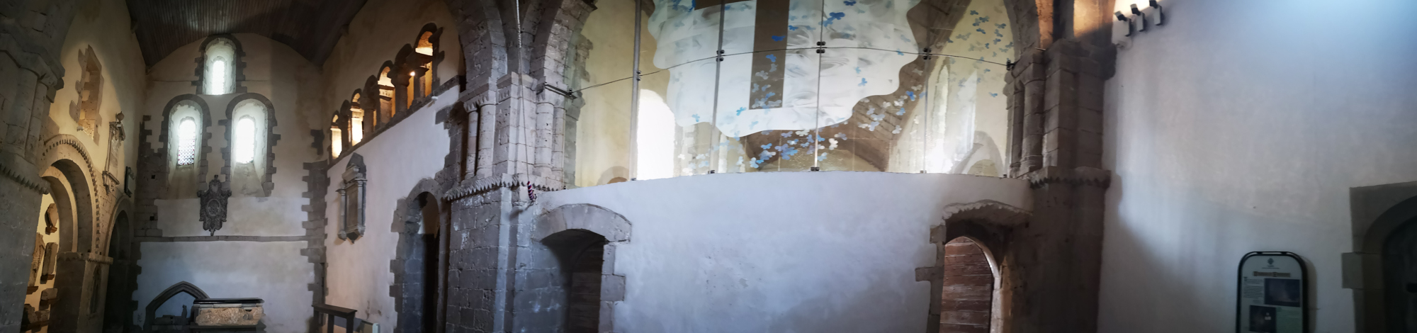
in St Illtud’s Church, Llantwit Major, Glamorgan Heritage Coast
Tuesday 8th October 2019 – indefinitely 2020
St Thomas Way is a modern pilgrimage trail inspired by a medieval story. This exhibition of artwork, created to help launch the trail in Hereford Cathedral in 2018 has been touring the trail which runs from Swansea to Hereford, from one beautiful medieval building to another ever since. It has been wonderfully stuck in the wonderful church of St Illtud’s in Llantwit Major for a very long time! I wonder how many times of severe crisis the walls there have witnessed? Some of them have been standing since the 6th century, so that means it’s weathered Viking invasions, the Norman conquest, the Black Death, the Reformation, and other famines and plagues – all must have impacted life here at some time or another.
William Cragh was hung in Swansea in 1290, but miraculously came back to life after he was laid out to be prepared for burial. He was sure he’d been saved by Thomas, the late Bishop of Hereford and walked barefoot from Swansea to Hereford Cathedral to say ‘thank you’.
“Measuring to the Saint”
In those days, it was common practice to measure the bodies of the sick, needy or dead, by running a length of string or thread from the top of a person’s head to the tip of their toes. This length would be curled up and sent to the nearest cathedral or priory, where the monks would make it into a candle, light it, and then pray for the person’s eternal soul.
It was when he was being measured to the saint that William came back to life. The idea that something as humble as a simple piece of string might connect this world and the next, or be able to spark life into our very souls, inspired artist Michelle Rumney, to use the medieval practice of ‘Measuring to the Saint’ as a starting point to create this exhibition for the launch of St Thomas Way.
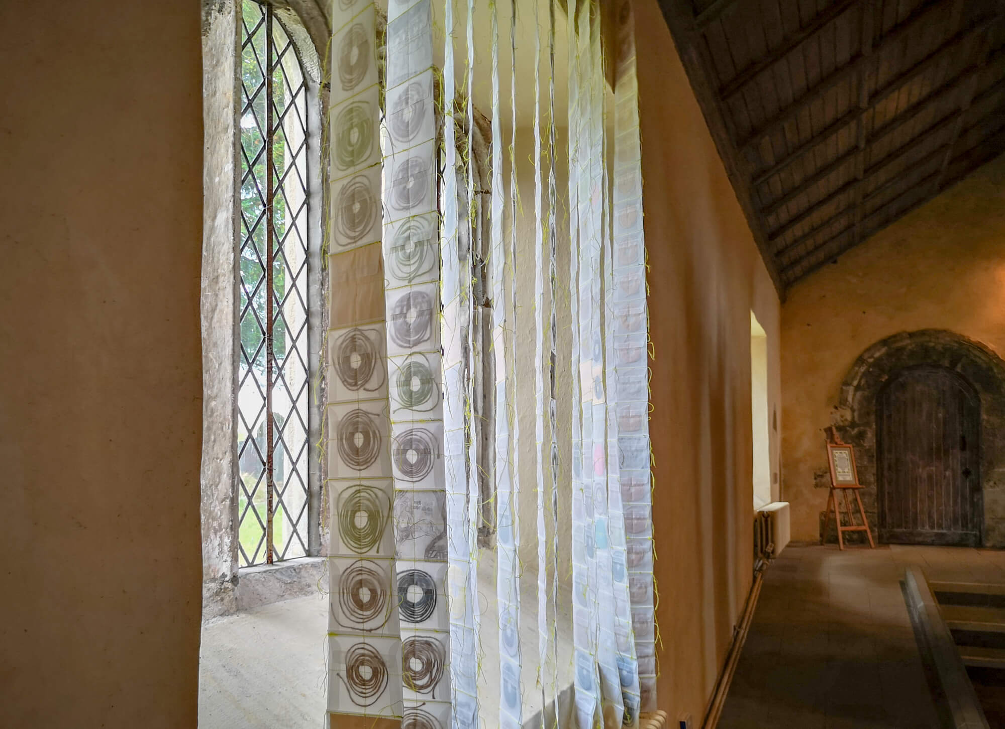


Hanging between the East Church and the West Church: ‘The Map of Mundi’
Michelle used the medieval practice of ‘Measuring to the Saint’ to create this large artwork.
Telling the tale of William Cragh as she went, she measured over 250 people (and one great dane and a teddy bear) with string. In her studio she coiled each string into a spiral, She stitched a cross over each one, before stitching them together.
She also measured Hereford Cathedral’s Mappa Mundi, a wonderful account of how people saw the world – and has included a few people, places and animals from that too.
When they finally arrived at St Thomas’ shrine at Hereford Cathedral, pilgrims would stop beside the map and gaze at this fantastical world whilst guides would tell them stories about the characters and places in it, some from the Bible, and others, from myths and medieval folklore. This was part of the pilgrimage experience, widening their personal understanding of the world as they knew it…
“Change the way you look at things and the things you look at change…”
In this contemporary ‘Map of Mundi’ there are 13 vertical strips, one for each waypoint on St Thomas Way and in all, there are 286 squares.
Some squares have been left empty deliberately and the piece is transparent so that you can glimpse through into another time and space – both in this wonderful chapel and in your own imagination.
If you’ve travelled along any part of St Thomas Way – or are about to – take a moment now to pause with your fellow ‘pilgrims’ – the ones physically present in the spirals in this ‘map’ – and also with the thousands of people over the centuries who’ve been present right here where you are now on their own journey…
Exhibition Mini-pilgrimage within the East Church
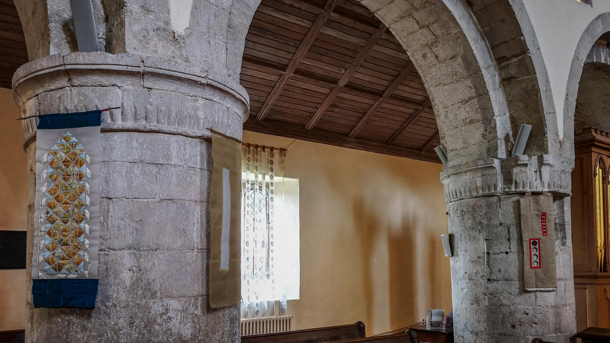
These artworks were created with church architecture in mind, with opportunities to reflect from different perspectives.
Begin by the curtain over the door at the entrance, then go into the church and up the far aisle right up towards the altar into the choir stalls, returnng by the main aisle back to the glass doors.
1. ‘Strip Map: St Thomas Way’
map pieces & stitching on paper on tapestry gauze
In the 17th Century, mapmakers like John Ogilby made maps for journeys helping travellers get from A to B. These ‘stripmaps’ showed the route as a straight line, rather like Google Maps does now. This strip map is the route of St Thomas Way, made from paper maps – never quite a straight line, but all the more interesting for it.
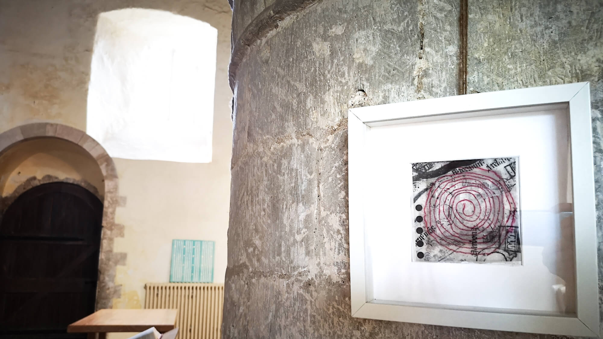
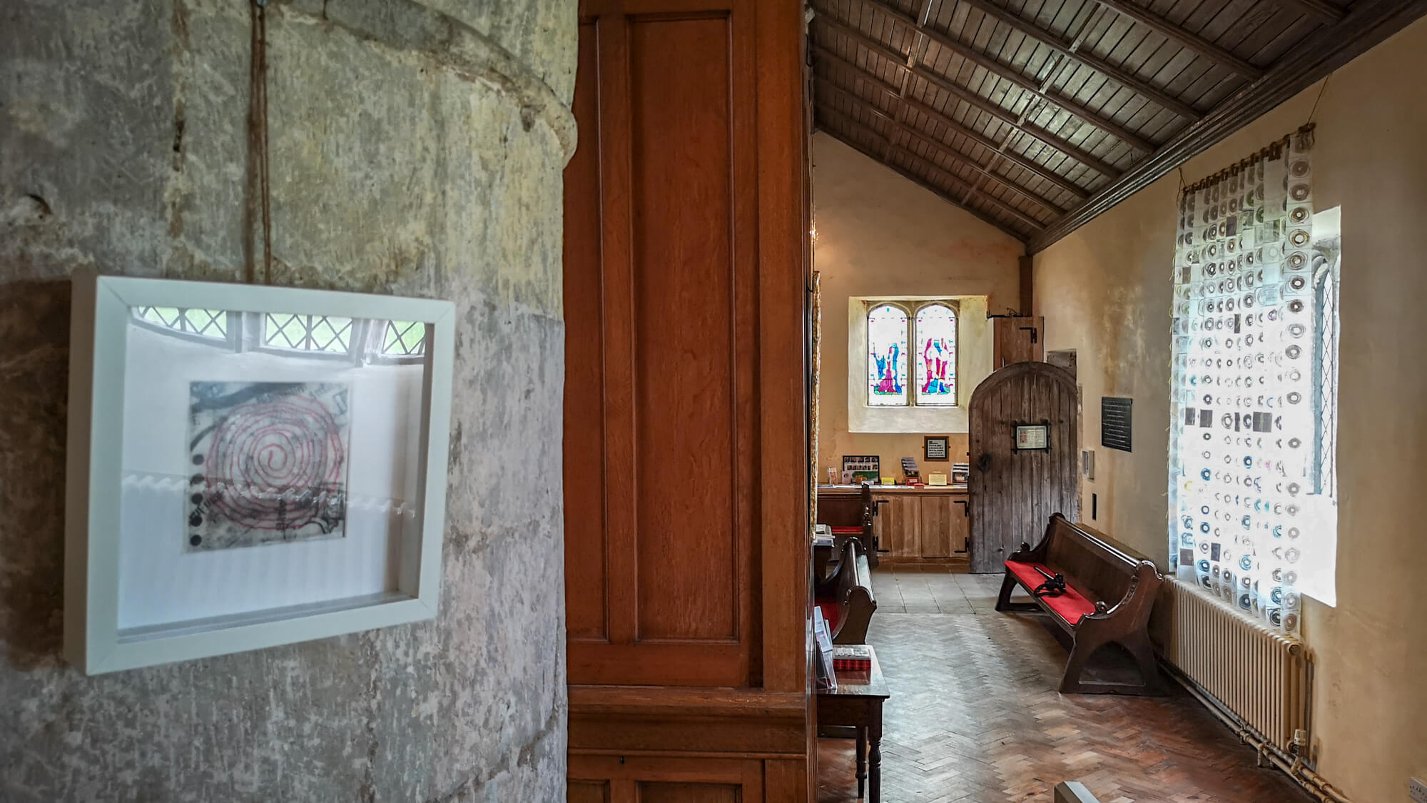
2. ‘Little Labyrinth – Measuring to the Saint’
string – artist’s length – on plastic coloured gel on ink on tracing paper on paper
A measured human length of string is spiralled around an image of the Labyrinth of Crete (the one where the Minotaur lived) from the medieval Mappa Mundi. Ariadne led Theseus safely out of this labyrinth – let your mind wander and weave some stories of your own around it.
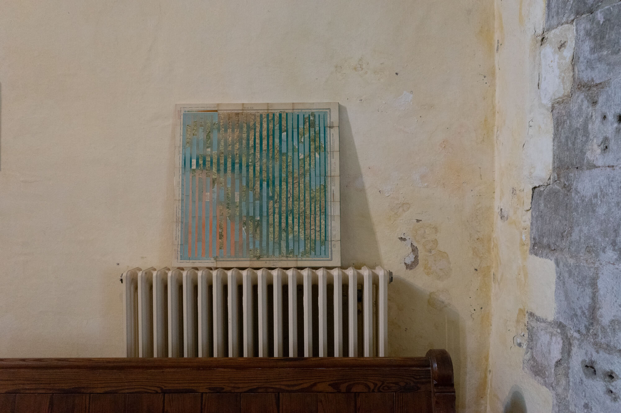
3. ‘(South) Wales’ (above Welcome table)
paper map pieces, gesso, pigment, glue & gold leaf on canvas
Formed of 3 identical maps of the same area, the place names on this map are connected with St Thomas Way. The blue strips of waters around the coast seem to have seeped into the landscapes here, breaking them up. Making a journey in medieval times was often dangerous, with river crossings and wild weather featuring highly in the things pilgrims needed to mind.
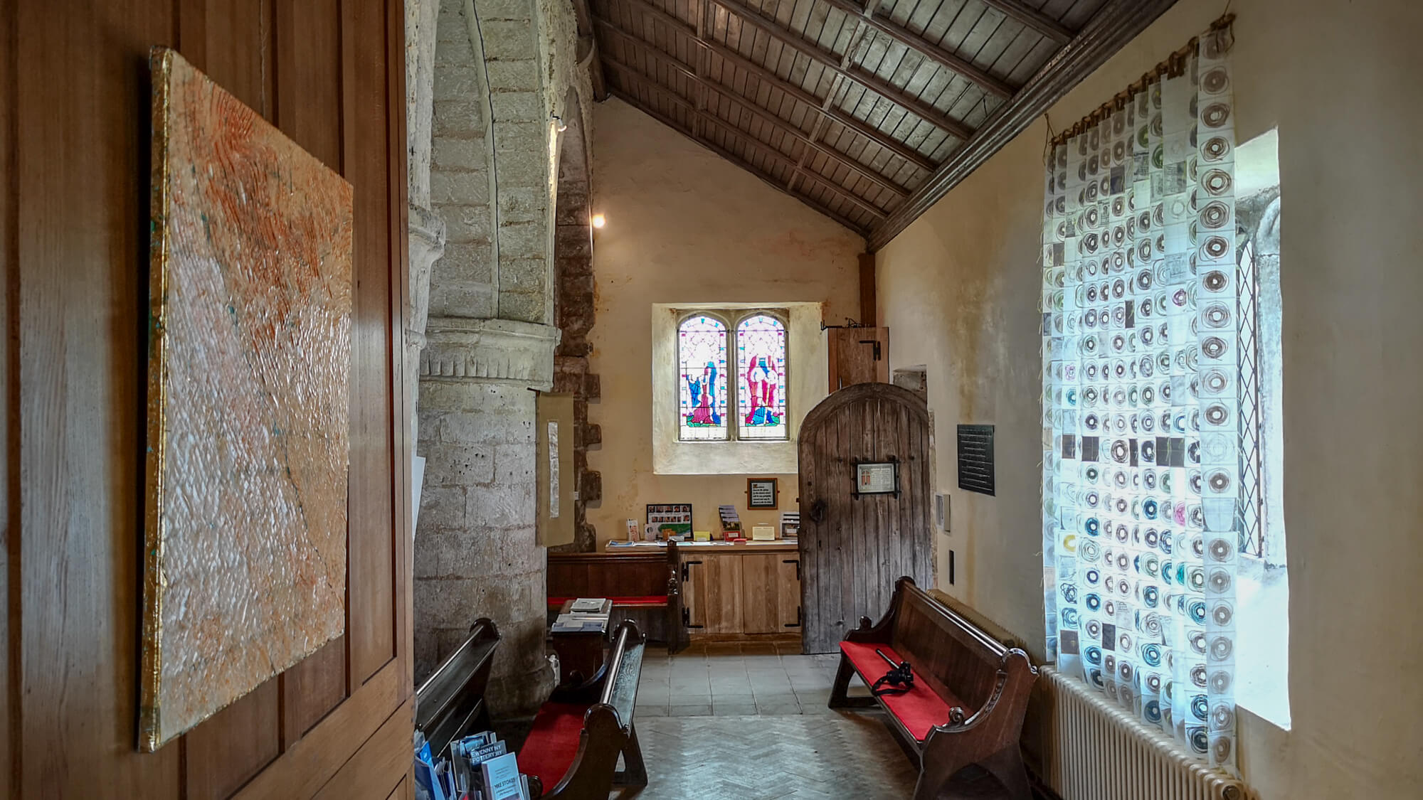
4. There is no Away’ (in far alcove at bottom of stairs)
thread, paper perforations, pigment, gesso & gold leaf on canvas
Maps help us make sense of where we are in relation to the rest of the world and to ourselves. These gridlines or coordinates are punctuated by empty circles – made from the perforated holes at the top of an artists sketchbook. These holes are the bits you’d normally throw ‘away’, yet the things we discard all still exist in some form somewhere – and there is no ‘away’.
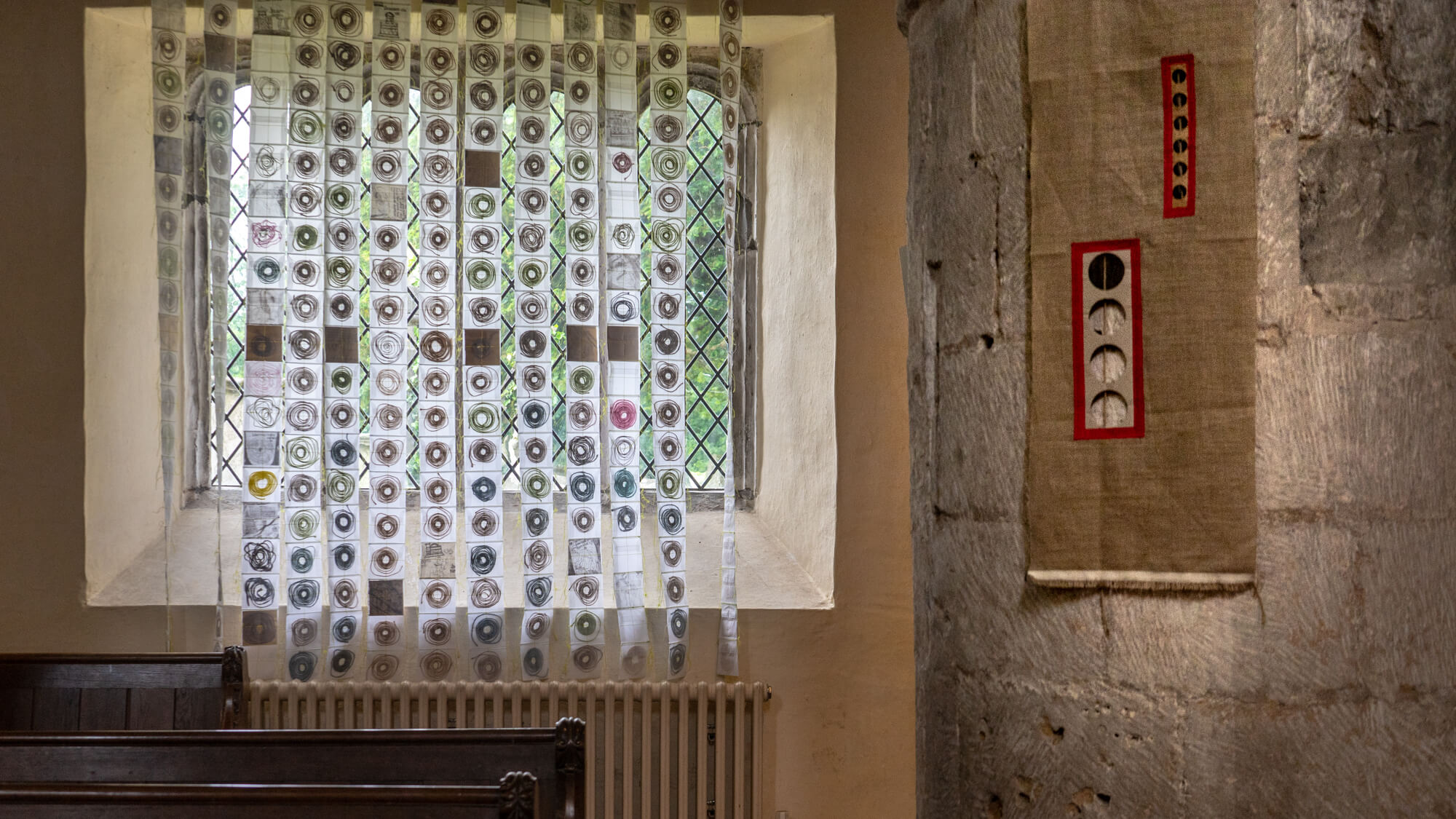
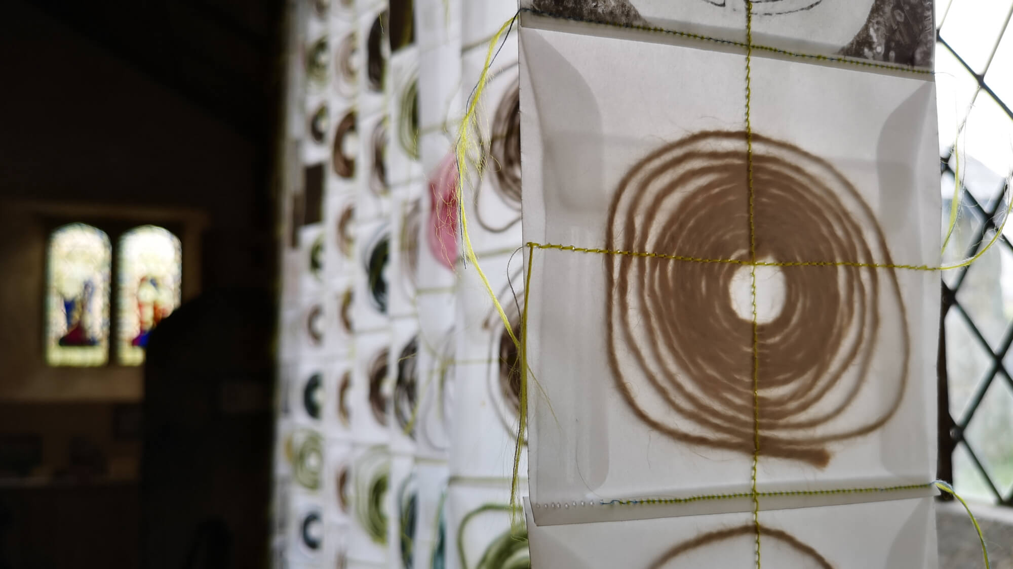
5. ‘Mappa Mundi Threads’
(on column with window bars)
hanging string, cardboard holes, bookcloth, & stitching on tracing paper
Look through the circular ‘windows’ and you’ll see a length of hanging string. This length of string is the diameter of the original Hereford Mappa Mundi, which has been “Measured to the Saint’. So, in another sense or at another scale, it could map the diameter of the world, or the distance between the poles… or anything…
6. ‘Window Map’
map pieces & glue on tracing paper
Triangulation is an important map-making tool, invented in 1533 by Gemma Frisius, which emerged from Islamic mathematical ideas of the High Middle Ages. Using triangular pieces of a map of South Wales, this map shows many of the places on or around the St Thomas Way.
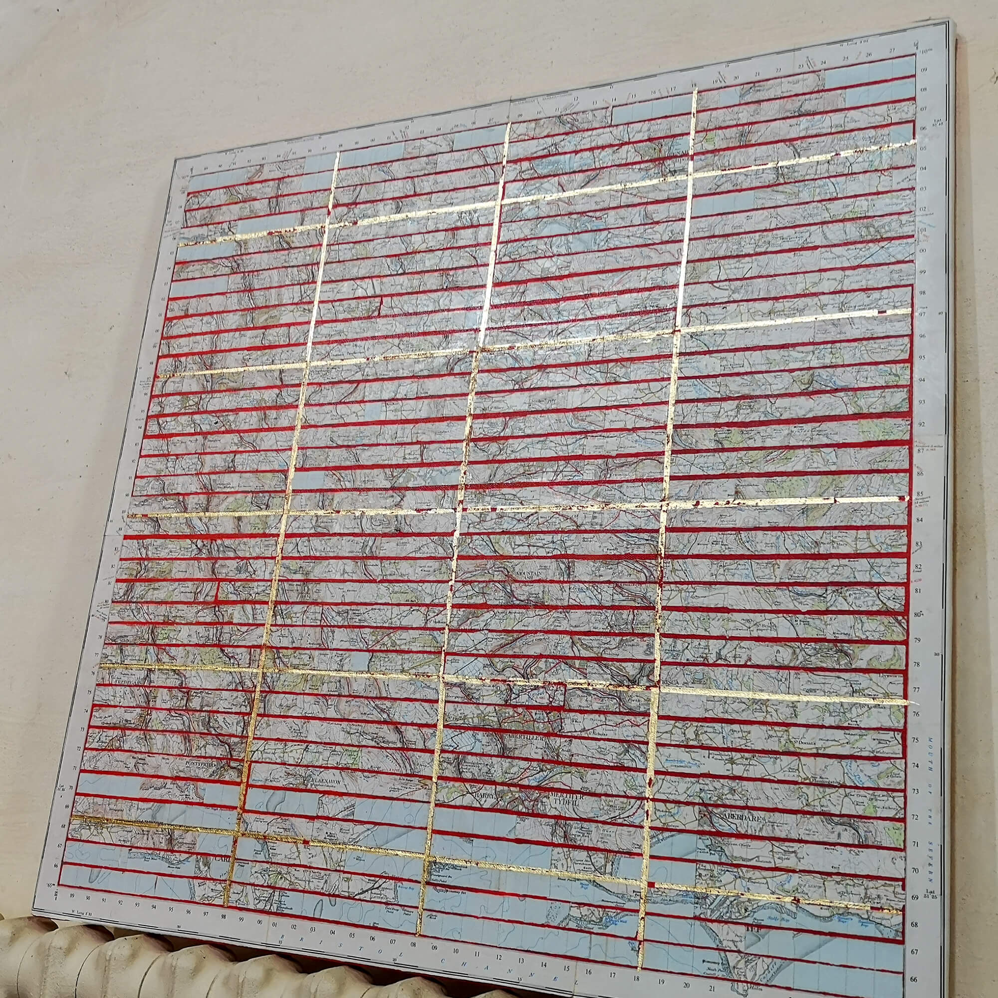
7. ‘On From Swansea’
paper map pieces, gesso, pigment, glue & gold leaf on canvas
The gridlines on this map have been stitched to stand up on the lands around Swansea, creating separate compartments, more divided than connected. A sequence of fake pearls reconnect the historic sections in the tale of Welsh outlaw William Cragh, from his attempt to burn down the castle at Oystermouth, through the castle where he was tried in Swansea, up to the gallows on MayHill where he was hung, and there are more stories in this landscape for sure.
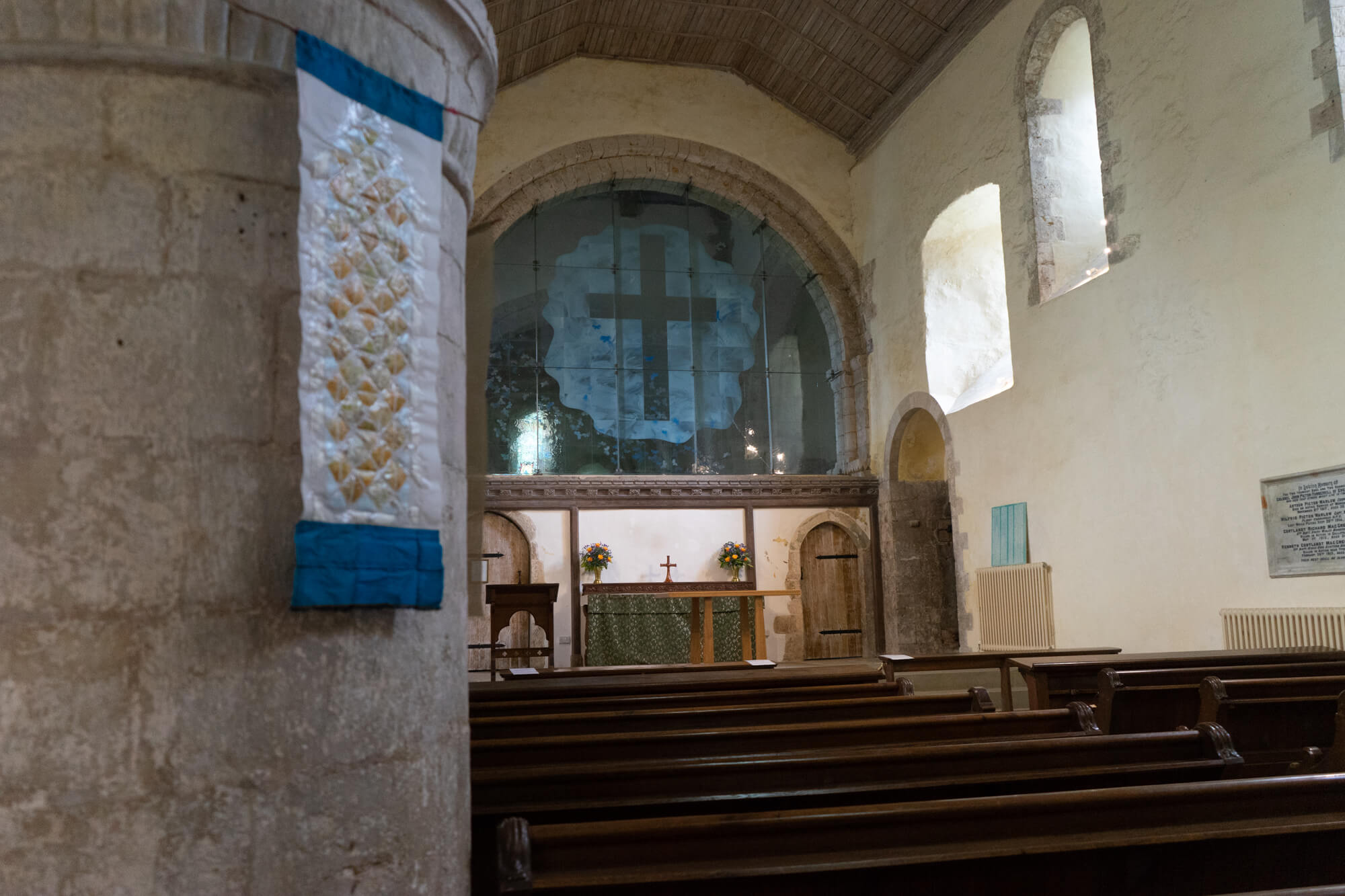
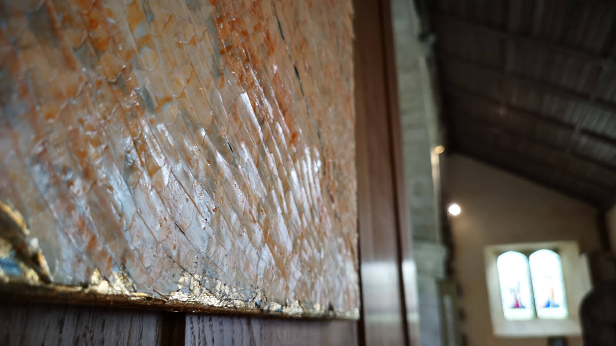
8. ‘Here Be (Welsh) Dragons’ (to left of altar)
paper map pieces, gesso, pigment, glue & gold leaf on canvas
Buried under this paper skin are pieces of a map, gridded out as if they make sense or mean something. There’s a crack forming, like a river, giving you more of a glimpse of where exactly this could be. In uncharted lands or waters on medieval maps, cartographers drew pictures of dragons as a symbol of potential danger. Later mapmakers imitated this, writing ‘Here be Dragons’ on their maps. This map takes that a stage further, being wrapped in dragon-like paper ‘scales’. I like to imagine it’s a Welsh one.
9. ‘Hanging Rope’
thick rope, ‘Measured to the Saint’ – artist’s length
The rope placed here is a reminder of the St Thomas Way story of William Cragh – ‘The Hanged Man’.
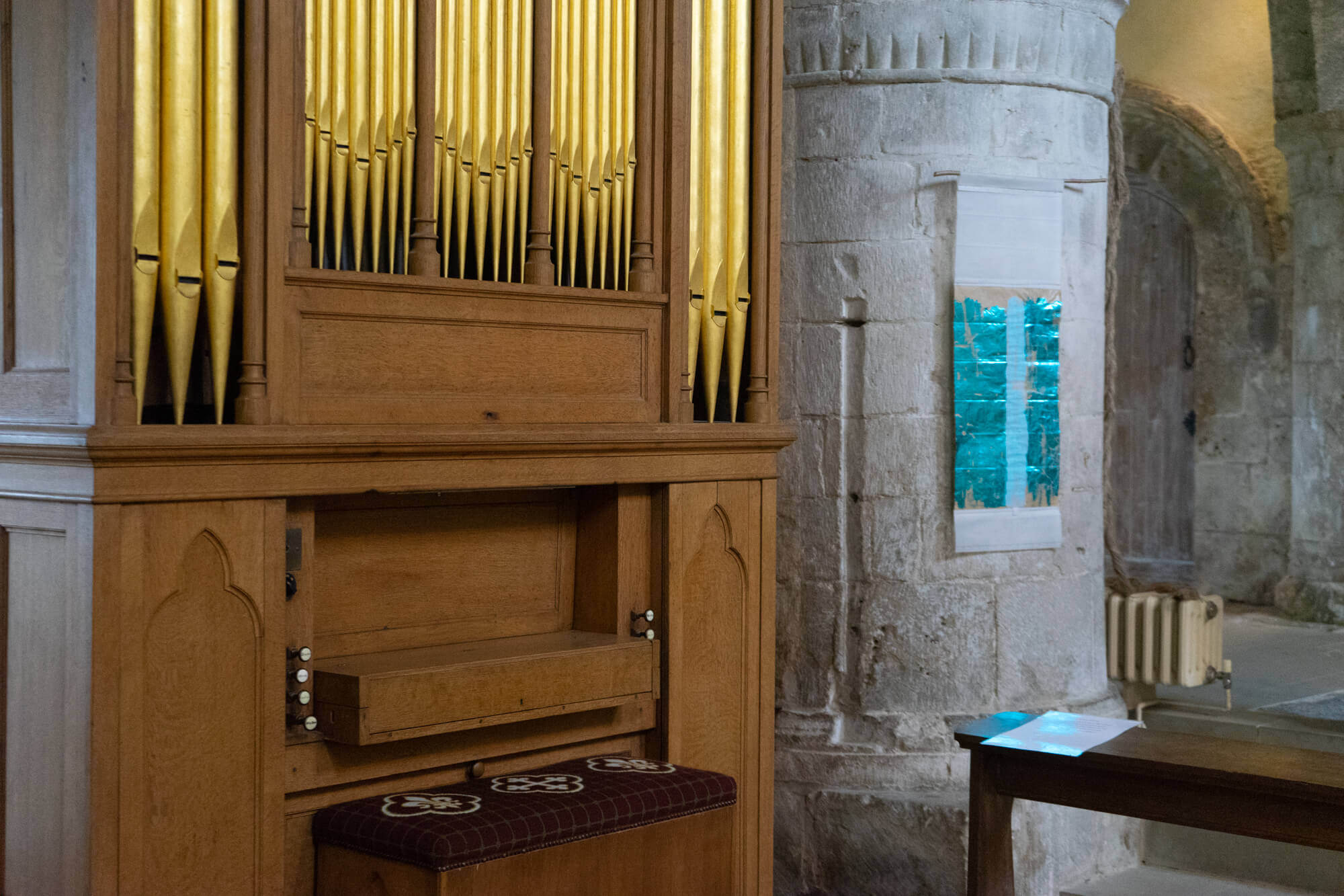
10. ‘Light Map’ (by Jesse Tree below slit window)
blue coloured foil, pencil, stitching & silk on tracing paper
The pencil line you can see if you look is traced from the original strip map of St Thomas Way (piece no.1 on black by the entrance door). The route crosses a blue ‘landscape’ and creates ripples or contours of its own. It reflects everything around it, and changes constantly as the light of the day progresses.
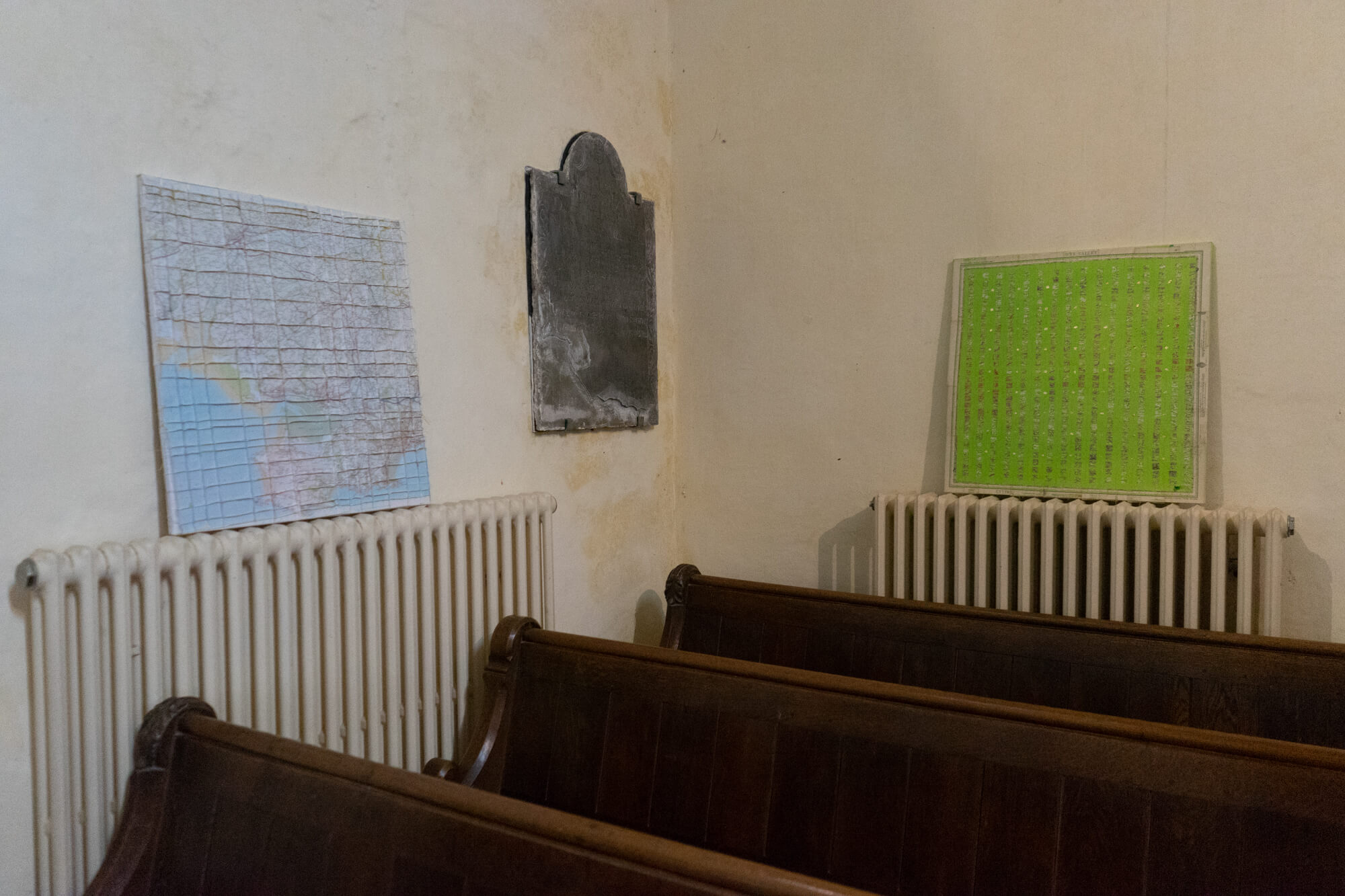
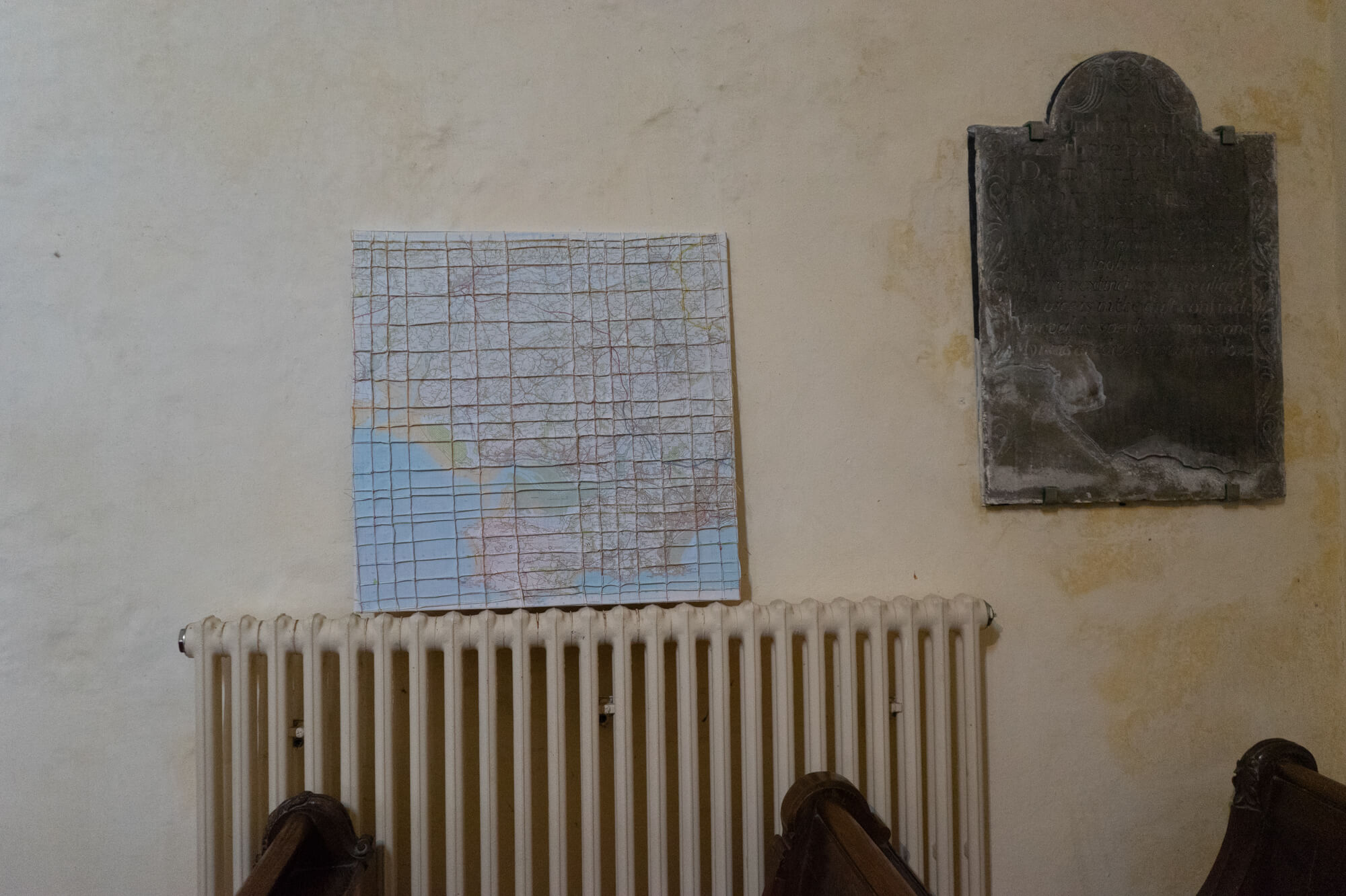
11. ‘Wye Valley’ (in central aisle)
paper map pieces, gesso, pigment, glue & gold leaf on canvas
This green and beautiful valley sits on the edge of both Wales and England and has centuries of history running through it. These square fragments are all part the St Thomas Way route – from Caerphilly and Newport, through Usk, Raglan and up to Abergavenny, Longtown, Kilpeck and Hereford. The pieces are from 3 identical maps of the area printed in different years. Has it changed much? Here, it certainly has, forming its own shimmering gridlines and landscape.
12. ‘Re-Newport & Cardiff’ (in far aisle)
paper map pieces, gesso, pigment, glue & gold leaf on canvas
Gridlines on a map help us relate to where we find ourselves and how we see where we are. Newport and Cardiff have undergone multiple changes since medieval times – deconstructions, reconstructions, and endless reworkings and reroutings, which can be disorienting and confusing even for locals. This piece is an attempt to make sense of things from the disrupted, but still beautiful, terrain.
13. ‘St Thomas Way Traces’ (one of hanging pair on wall)
pencil on tracing paper & stitching on tapestry gauze
This single pencil line is a tracing of the St Thomas Way strip map (on black) by the door. Presented like this, it could represent many things: a trail that leads through many centuries; a journey across an invisible border between England and Wales; and the actual pilgrimage route – which would be 74 miles as the crow flies, but is much, much longer if travelling on foot (barefoot) as William Cragh did, especially as he was also wearing a hangman’s noose around his neck, which must have slowed him down.
14. ‘St Thomas Way: Red Thread Shadow’
red thread stitching on gossamer gauze on tapestry gauze
Another tracing of the St Thomas Way strip map (no. 1), but this time stitched in red thread on gossamer translucent gauze. When light is shone through this piece the red line presents a delicate shadow of the route of St Thomas Way.
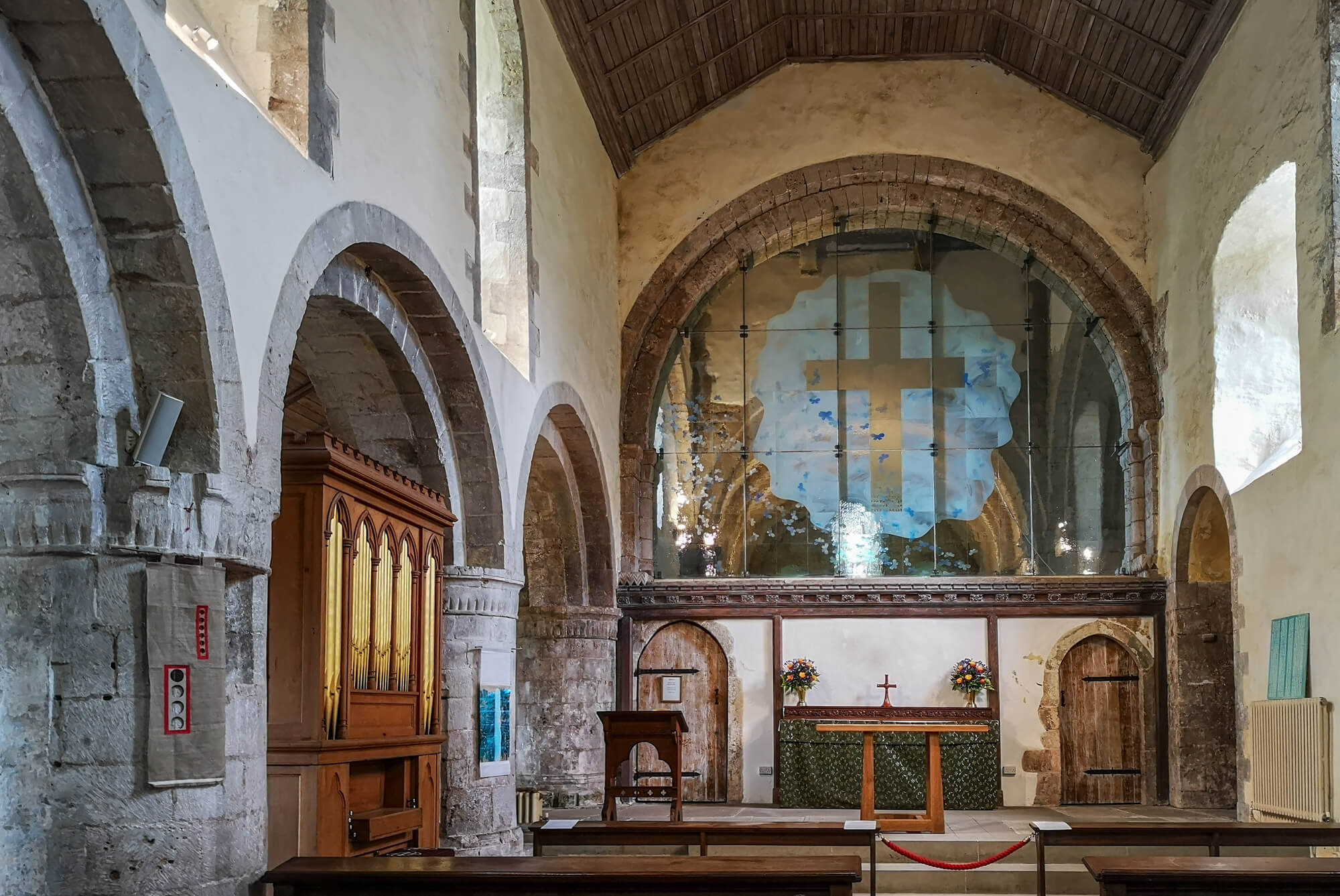
15. ‘The Map of Mundi’ (large piece in the huge glass window)
spirals of measured string & thread, gold leaf, images from Hereford’s ‘Mappa Mundi’ c. 1290, thread and stitching on paper envelopes
Michelle used the medieval practice of ‘Measuring to the Saint’ to create this large artwork. Telling the tale of William Cragh as she went, she measured over 250 people (and one great dane and a teddy bear) with string. In her studio she coiled each string into a spiral, She stitched a cross over each one, before stitching them together.
She also measured Hereford Cathedral’s Mappa Mundi, a wonderful account of how people saw the world – and has included a few people, places and animals from that too.
When they finally arrived at St Thomas’ shrine at Hereford Cathedral, pilgrims would stop beside the map and gaze at this fantastical world whilst guides would tell them stories about the characters and places in it, some from the Bible, and others, from myths and medieval folklore. This was part of the pilgrimage experience, widening their personal understanding of the world as they knew it…
In this contemporary ‘Map of Mundi’ there are 13 vertical strips, one for each waypoint on St Thomas Way and in all, there are 286 squares. Some squares have been left empty deliberately and the piece is transparent so that you can glimpse through into another time and space – both in this wonderful church and in your own imagination. Father Edwin likes to light it in different colours too!
If you’ve travelled along any part of St Thomas Way – or are about to – take a moment now to pause with your fellow ‘pilgrims’ – the ones physically present in the spirals in this ‘map’ – and also with the thousands of people over the centuries who’ve been present right here where you are now on their own journey…
16. ‘Little Labyrinth – Measuring to the Saint’ (in gift shop)
coloured cotton thread – artist’s length – on ink on tracing paper on paper – price £50 framed
The practice of Measuring to the Saint is central to this exhibition. This measured human length of pink modern thread is spiralled around an image from the medieval Mappa Mundi.
Labyrinth spirals are a way of taking a long journey in a small space. Let your mind wander and weave some stories of your own around it…
17. ‘Little Labyrinth – Measuring to the Saint’ (in gift shop)
coloured cotton thread – artist’s length – on ink on tracing paper on paper – price £50 framed
A measured human length of blue modern thread is spiralled around an image of a camel from the medieval Mappa Mundi.
More pieces like this can be made to order direct from the artist:
2020 EXHIBITION TOUR
The St Thomas Way exhibition is (or at least, was) constantly on the move itself, travelling to different places along this new heritage trail – from Swansea St Mary’s to Hereford Cathedral and many places in between. We’re hoping eventually it will visit St Fagan’s near Cardiff and Caerphilly Castle, which are also on the trail.
Each time the exhibition moves to a new place, the way the artworks present themselves changes too. This is the second time it’s been presented here in St. Illtud’s and it’s more than a pleasure to see it return. Thanks to Father Edwin for facilitating this.
In 2020, amid everything else going on, we celebrate both the 700th anniversary of the canonisation of Bishop Thomas Cantilupe of Hereford and the 850th anniversary of the martyrdom of Archbishop Thomas Becket of Canterbury.
From July-September 2020, this exhibition is due to return to Hereford Cathedral for The Two Thomases Exhibition. I hope this is still possible – please join the mailing list at the bottom of the page and I’ll send you updates.
Also, for Southwark Cathedral, I have created a new piece in honour of Thomas Becket for the Lent Art Installation 2020 called “Pilgrimage: Finding Each Other in the Paradise of Free Souls”.
Find out more about the trail online:
St Thomas Way
Google Streetview
Google lent us one of their street view cameras to upload as many places on the trail as possible.
Take a look at St Thomas Way’s Street View contributions:
https://www.google.com/maps/contrib/116225238041559704267/photos