
Re-Making Maps of the Mind Exhibition
Saturday 7th July – Tuesday 14th August 2018
Medieval and Modern Journeys
In making this artwork for St Thomas Way, artist-in-residence Michelle Rumney has been exploring the medieval practice of ‘Measuring to the Saint’.
In the year 1290 when William Cragh was hung, it was common practice to help the sick, needy or in his case, dead, by running a length of string or thread from the top of a person’s head to the tip of their toes. This length would be curled up
and sent to the nearest cathedral or priory, where the monks would make it into a candle, light it, and then pray for the person’s eternal soul.
It was when William was being measured to the saint that he came back to life – one of about 200 miracles reported and attributed to Thomas, the late Bishop of Hereford, at the time.
“Change the way you look at things and the things you look at change…”
Artwork in the Nave
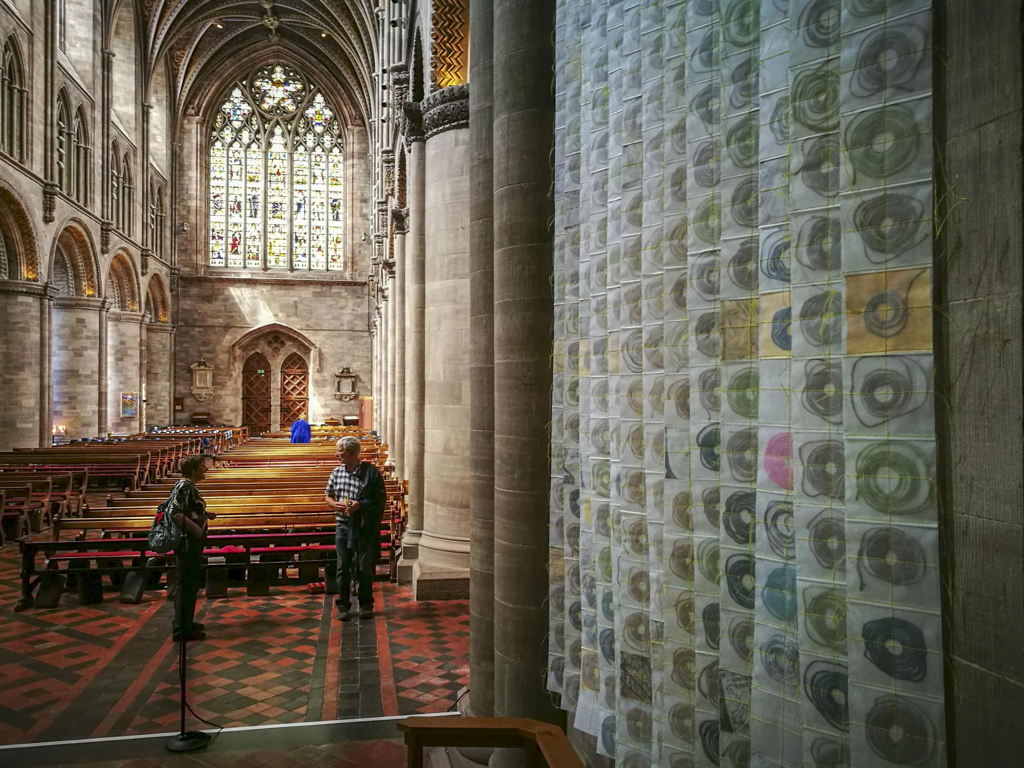
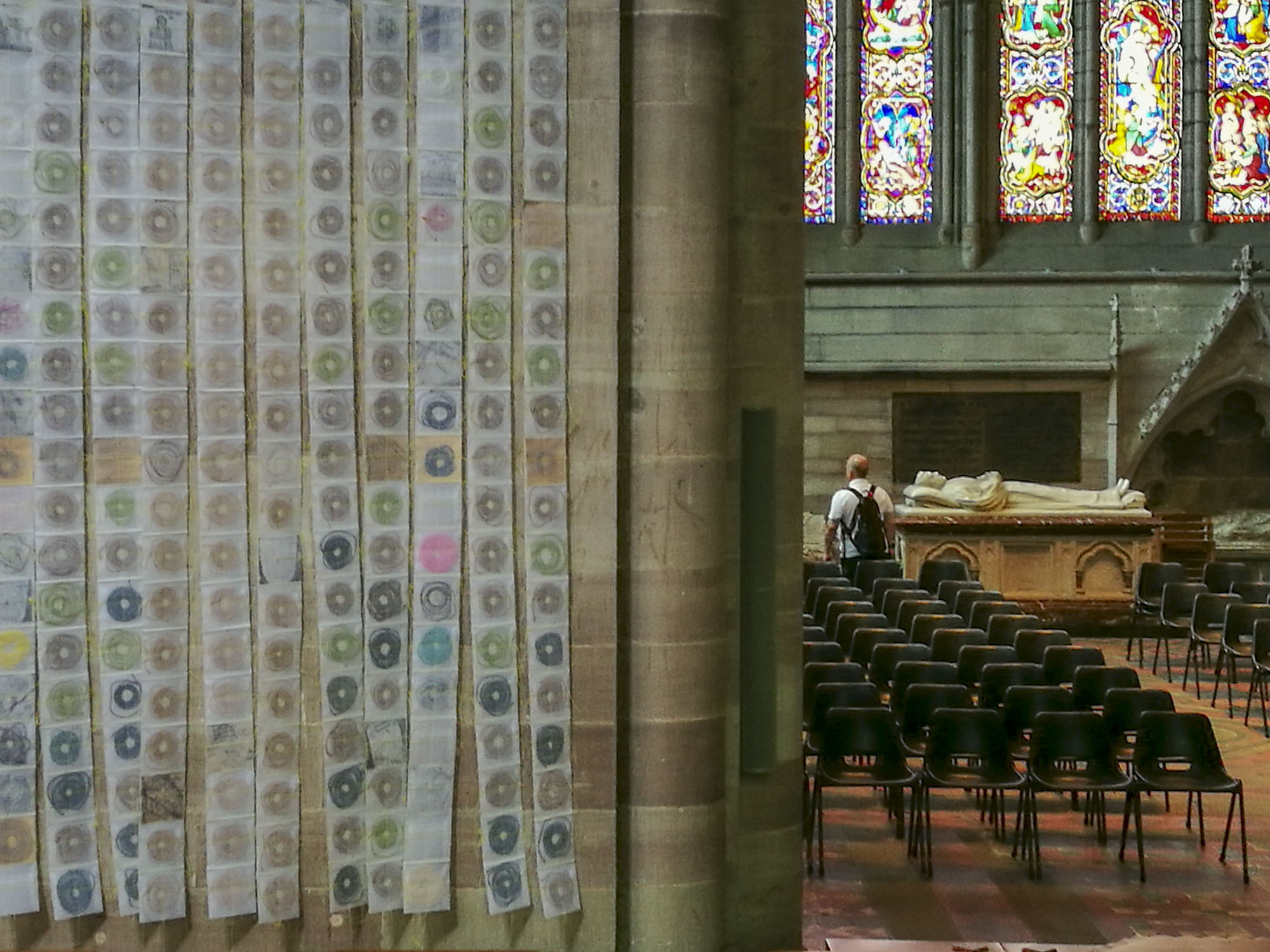
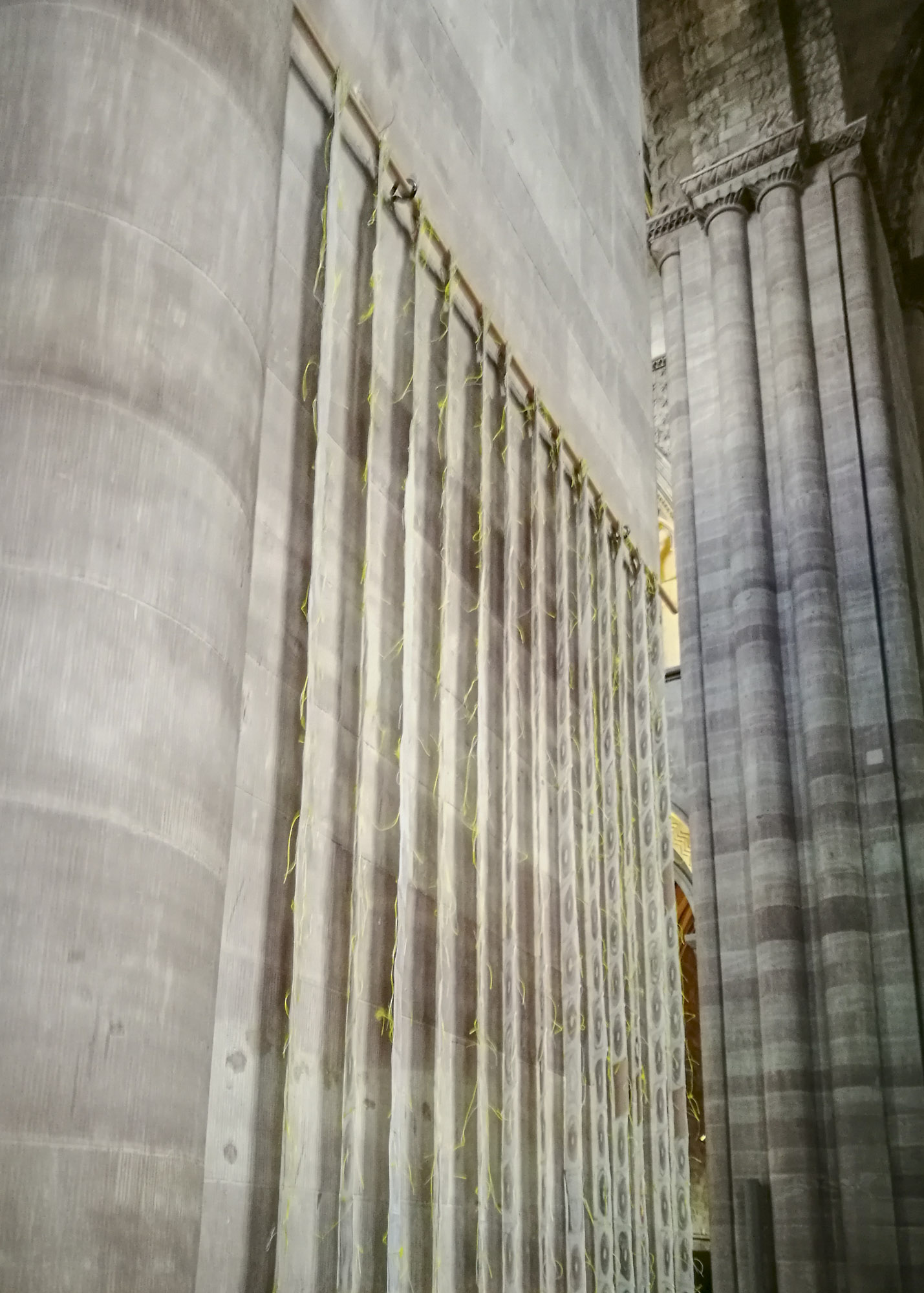
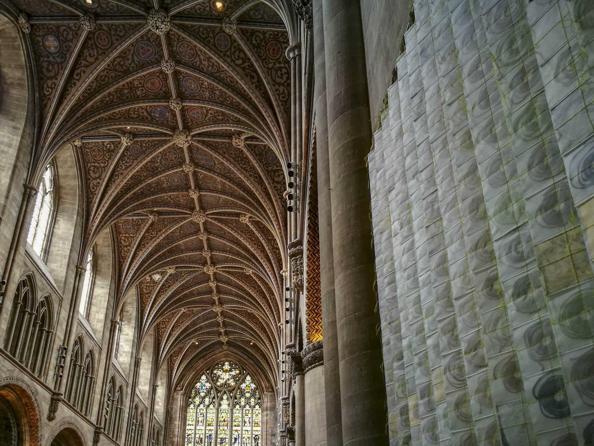
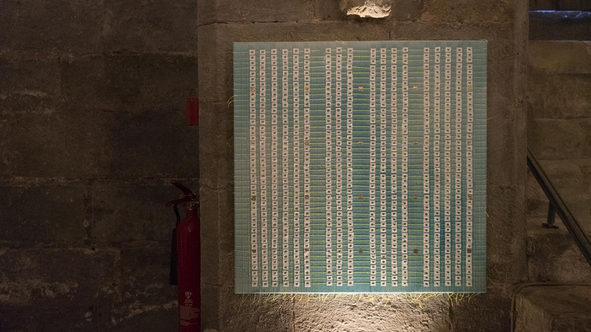
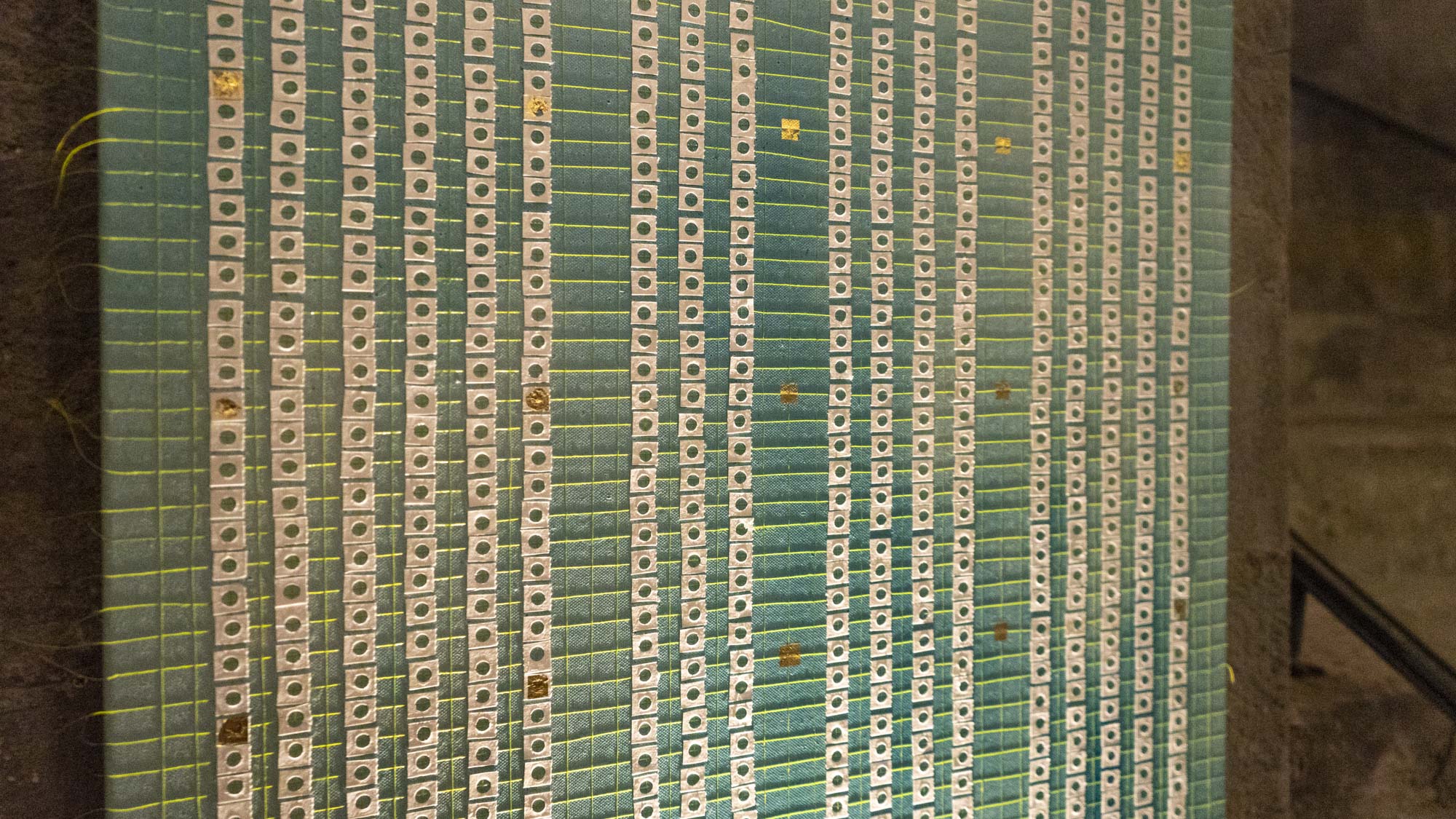
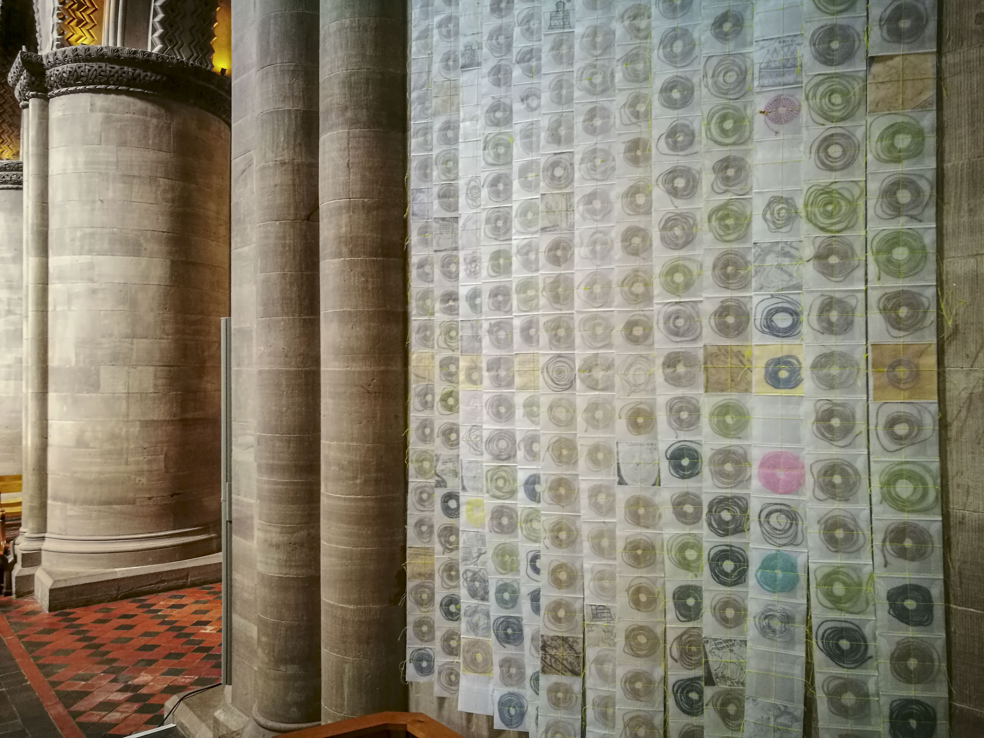
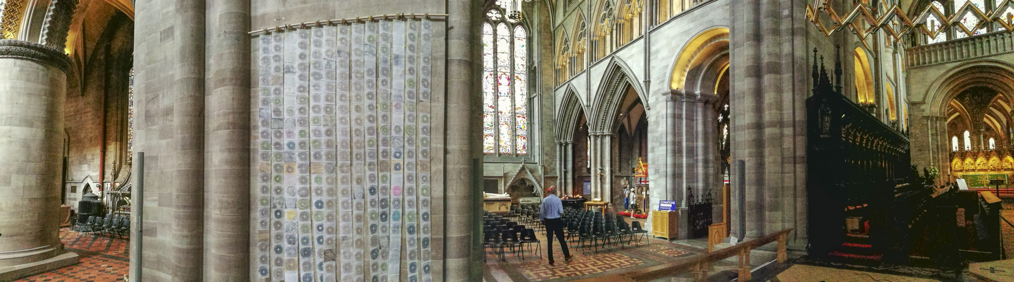
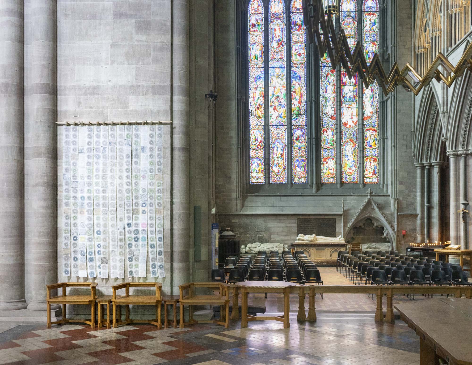
‘The Map of Mundi’ (on the Tower pier facing North transept)
The idea that something as humble as a simple piece of string might connect this world and the next, or be able to spark life into our very souls, inspired Michelle to literally use ‘Measuring to the Saint’ to create this artwork. She measured over 250 people – plus one great dane and a teddy bear – to form the 13 strips, one for each waypoint on St Thomas Way.
In all, there are 286 squares. Some squares have been left empty deliberately and the piece is transparent showing glimpses of the wall behind it. As Michelle says “this wall has stood here bearing witness to pilgrims for nearly 800 years and is beautiful in itself – it’s another window through time, so I wanted people to look at it too.”
There are also a few squares with strange and wonderful images from the Mappa Mundi, a reminder of this incredible map which was originally very much part of a St Thomas pilgrims’ experience. When they finally arrived at St Thomas’ shrine, pilgrims would stop beside the map and gaze at this fantastical world whilst guides would tell them stories about the characters and places in it, some from the Bible, and others, from myths and medieval folklore.
If you’ve travelled along any part of St Thomas Way – or are about to – take a moment now to pause with your fellow ‘pilgrims’ – those here and now on this wall – and perhaps also with the thousands (who really knows how many?) who’ve passed this way before…

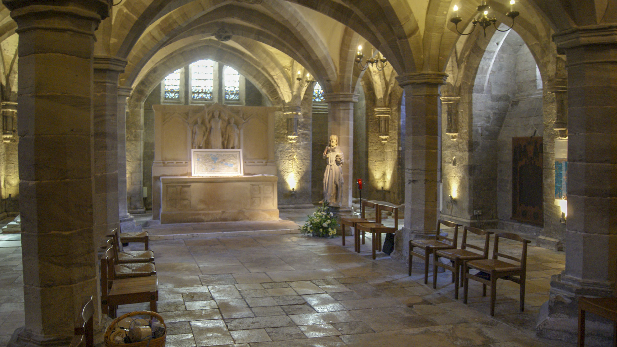

Exhibition in the Crypt
The artworks were created with the architecture of this contemplative space in mind… like a mini-pilgrimage, with opportunities to reflect from different perspectives, moving clockwise from the blue piece at the foot of the steps:
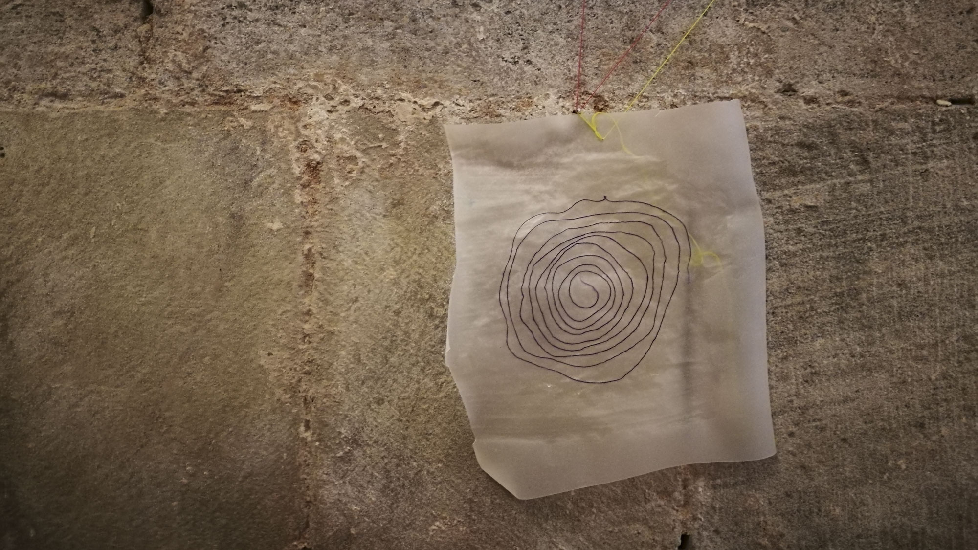
1. ‘There is no Away’
thread, paper perforations, pigment, gesso & gold leaf on canvas
Maps help us make sense of where we are in relation to the rest of the world and to ourselves. These gridlines or coordinates are punctuated by empty circles – made from the perforated holes at the top of an artists sketchbook. These holes are the bits you’d normally throw ‘away’, yet the things we discard all still exist in some form somewhere – and there is no ‘away’.
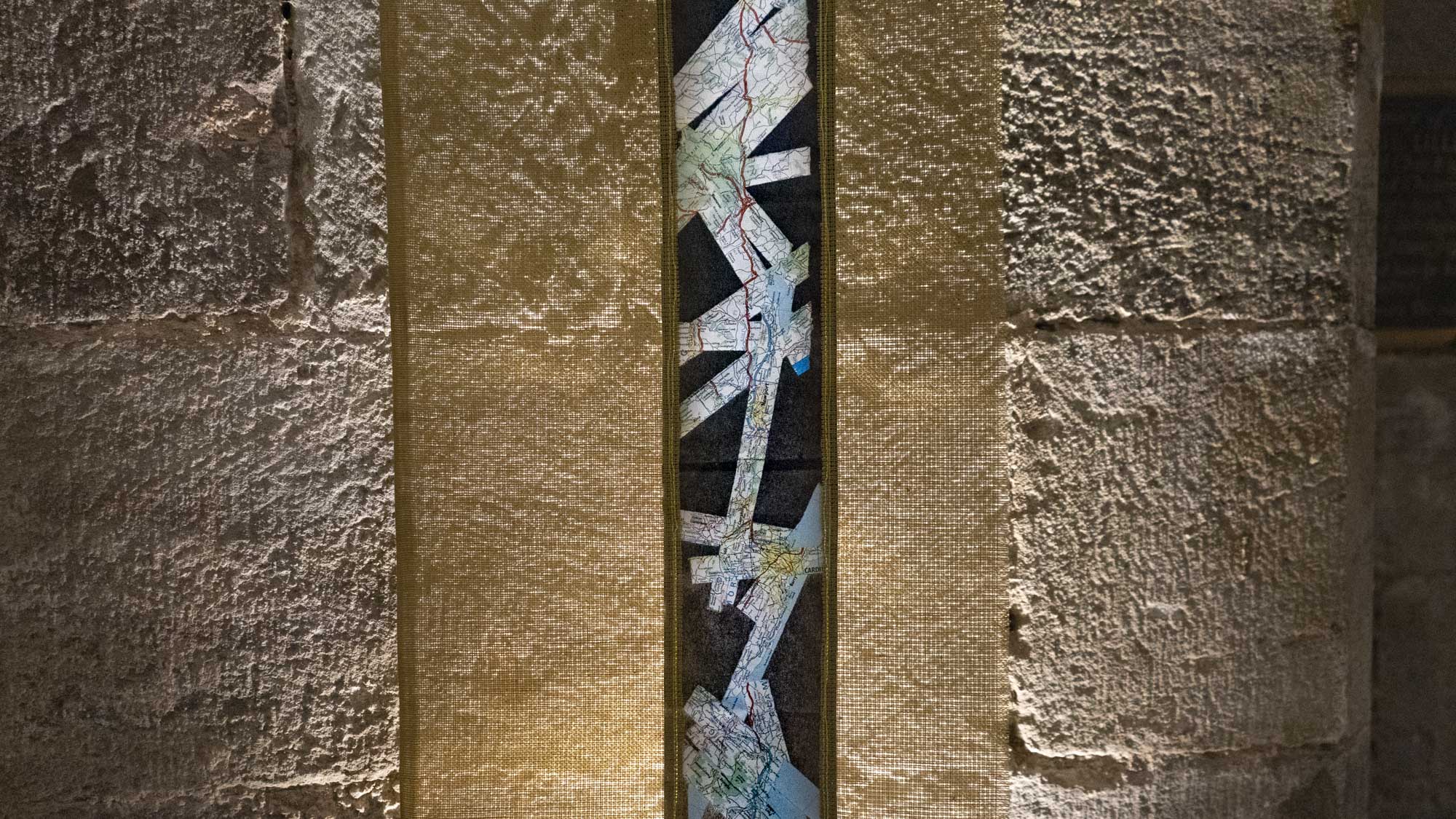
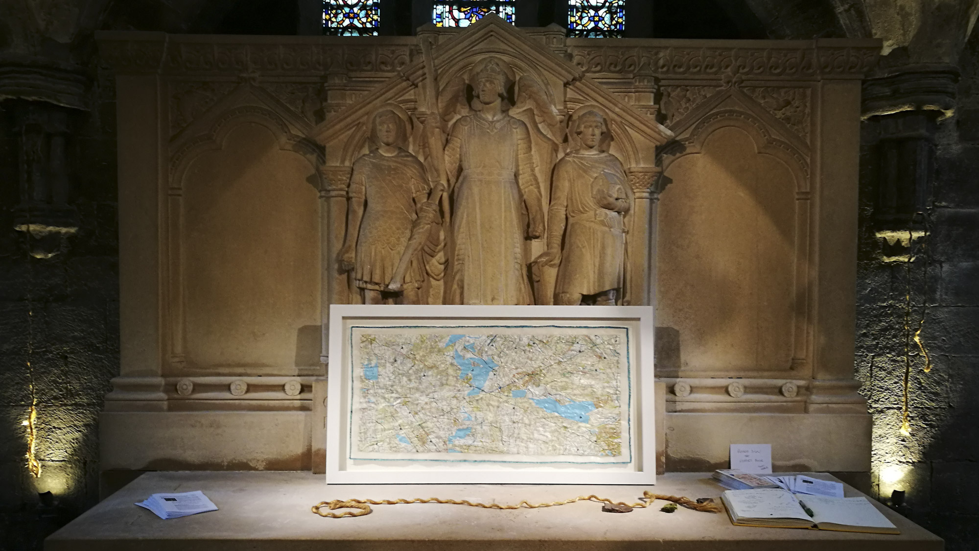
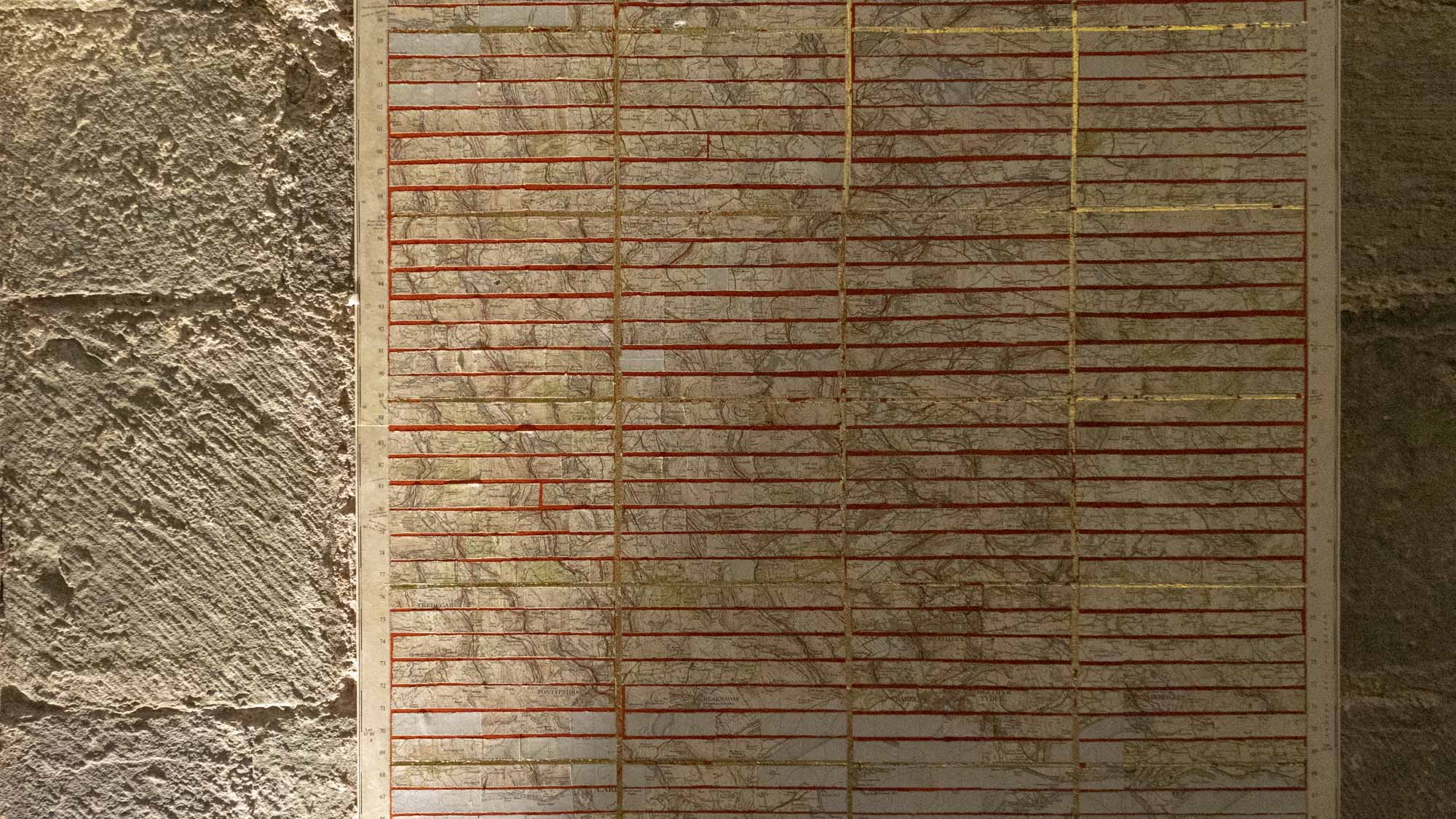
2. ‘Strip Map: St Thomas Way’
map pieces & stitching on paper on tapestry gauze
In the 17th Century, mapmakers like John Ogilby made maps for journeys helping travellers get from A to B. These ‘strip maps’ showed the route as a straight line, rather like Google Maps does on our mobile devices now. This one is the route of St Thomas Way, made from paper maps – never quite a straight line, but all the more interesting for it.
3. ‘St Thomas Way Traces’
pencil on tracing paper & stitching on tapestry guaze
A tracing of the ‘straight line’ of the previous map. This single pencil line may represent many things: a trail that leads through eight centuries; a journey across an invisible national border; and a route that would be 74 miles as the crow flies, but is much, much longer if travelling on foot as William Cragh did, especially as he was also wearing a hangman’s noose around his neck…
4. ‘From You to Me’
two ropes, hanging either side of the altar, uplit
These two strands cut from the same rope are identical in length – the length of the artist when ‘Measured to the Saint’. The lines they each take are not nearly the same, and they are separate, but there are many connections between them.
Can two journeys ever really be the same?
5. ‘From Me to You’
map pieces, glue & stitching on tracing paper
A ‘strip map’ of sorts showing a route the artist has travelled many times – from her home in Dorset to the home of one of her dearest friends in Hereford. The route travels up Zig-Zag Hill near Shaftesbury, around Bristol, across the Severn Bridge and along the Wye Valley past Tintern Abbey. The journey usually takes about 4 hours. Instead of a straight line, the map takes the form of a cross or kiss and forms its own new landscapes.
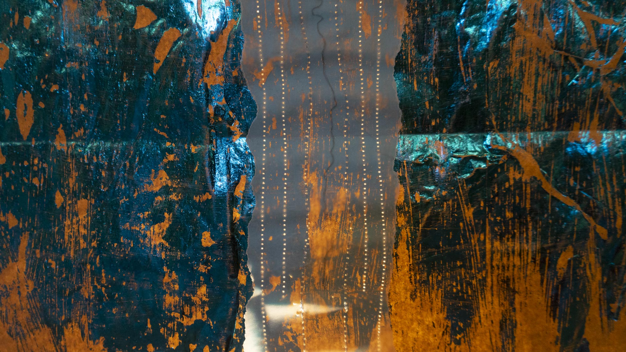
6. ‘Doorway Map’
pencil, coloured foil, stitching & silk on tracing paper
Another edition of the original strip map. This time, the route crosses a blue ‘landscape’ and creates ripples or contours of its own. Visually, it echoes the medieval door parts on the (medieval) wall behind it.
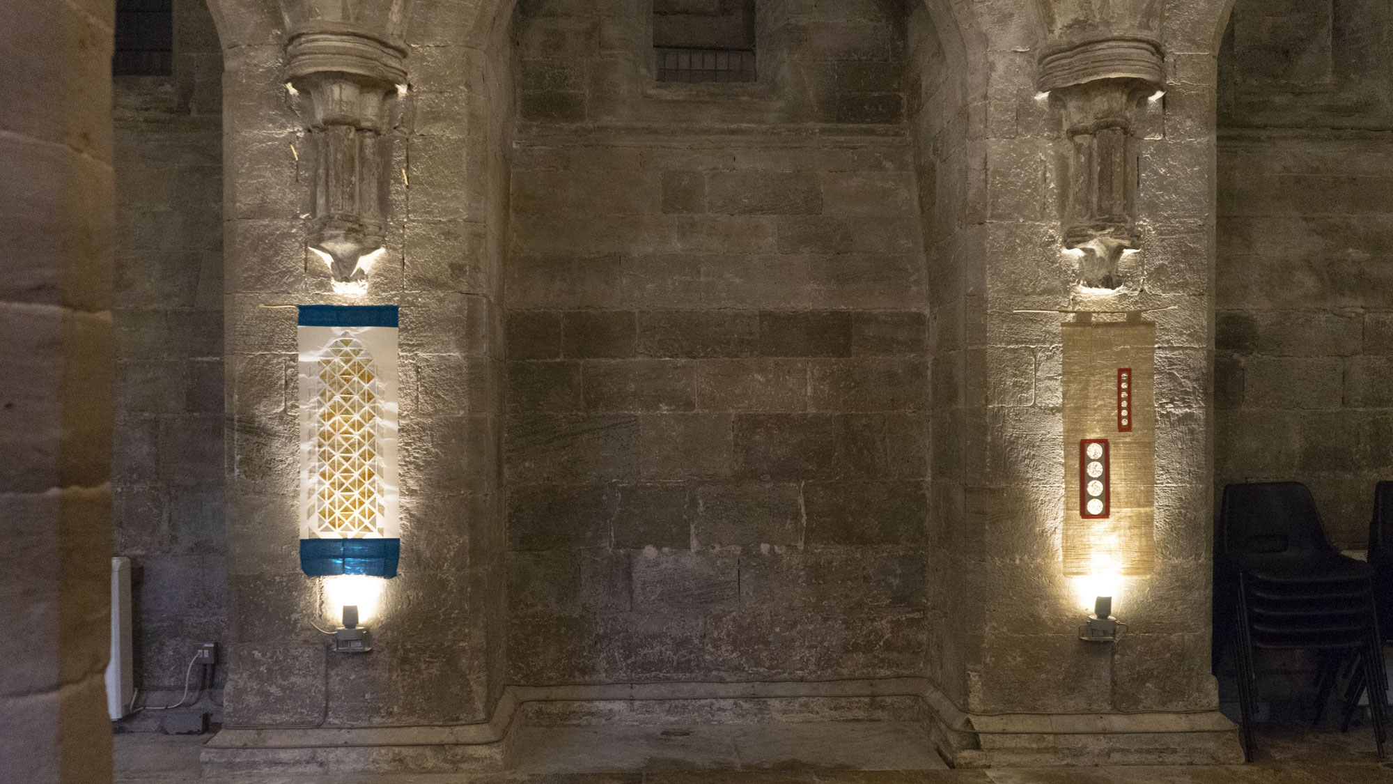
7. ‘Window Map’
map pieces & glue on tracing paper
Triangulation is an important map-making tool, invented in 1533 by Gemma Frisius, which emerged from Islamic mathematical ideas of the High Middle Ages. Using triangular pieces of a map of South Wales, this map shows many of the places on or around the St Thomas Way, making new connections and spaces between them.
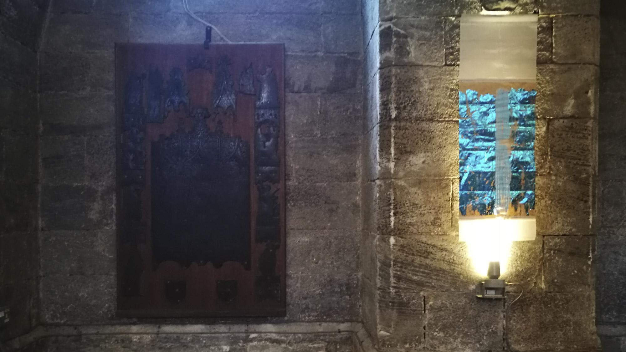
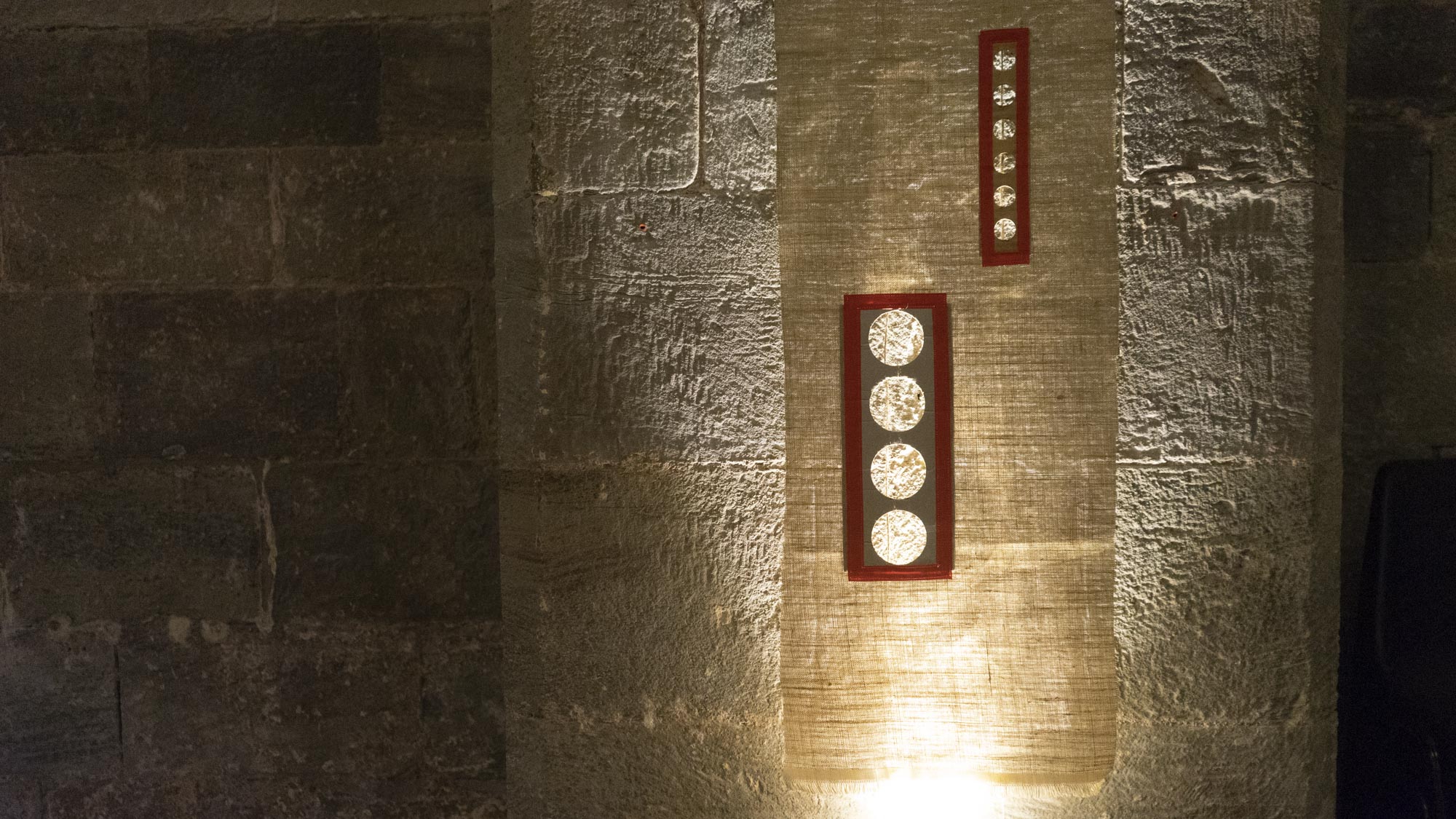
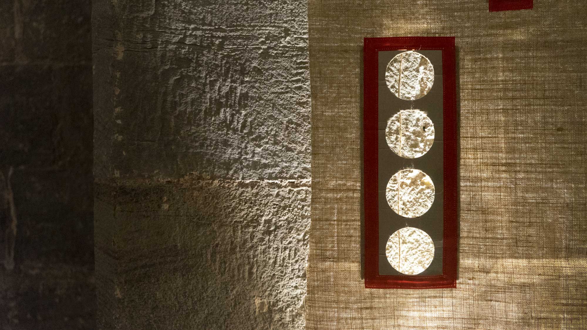
8. ‘Mappa Mundi Threads’
hanging string, cardboard holes, bookcloth, & stitching on tracing paper
Look through the circular ‘windows’ and you’ll see a length of hanging string. The string in question is another length “Measuring to the Saint’ but this time a measured map – the diameter of the original Hereford Mappa Mundi, measured upstairs. So, in another sense or at another scale, it could map the diameter of the world, or the distance between the poles, or the girth of the calf on whose hide the map was drawn…
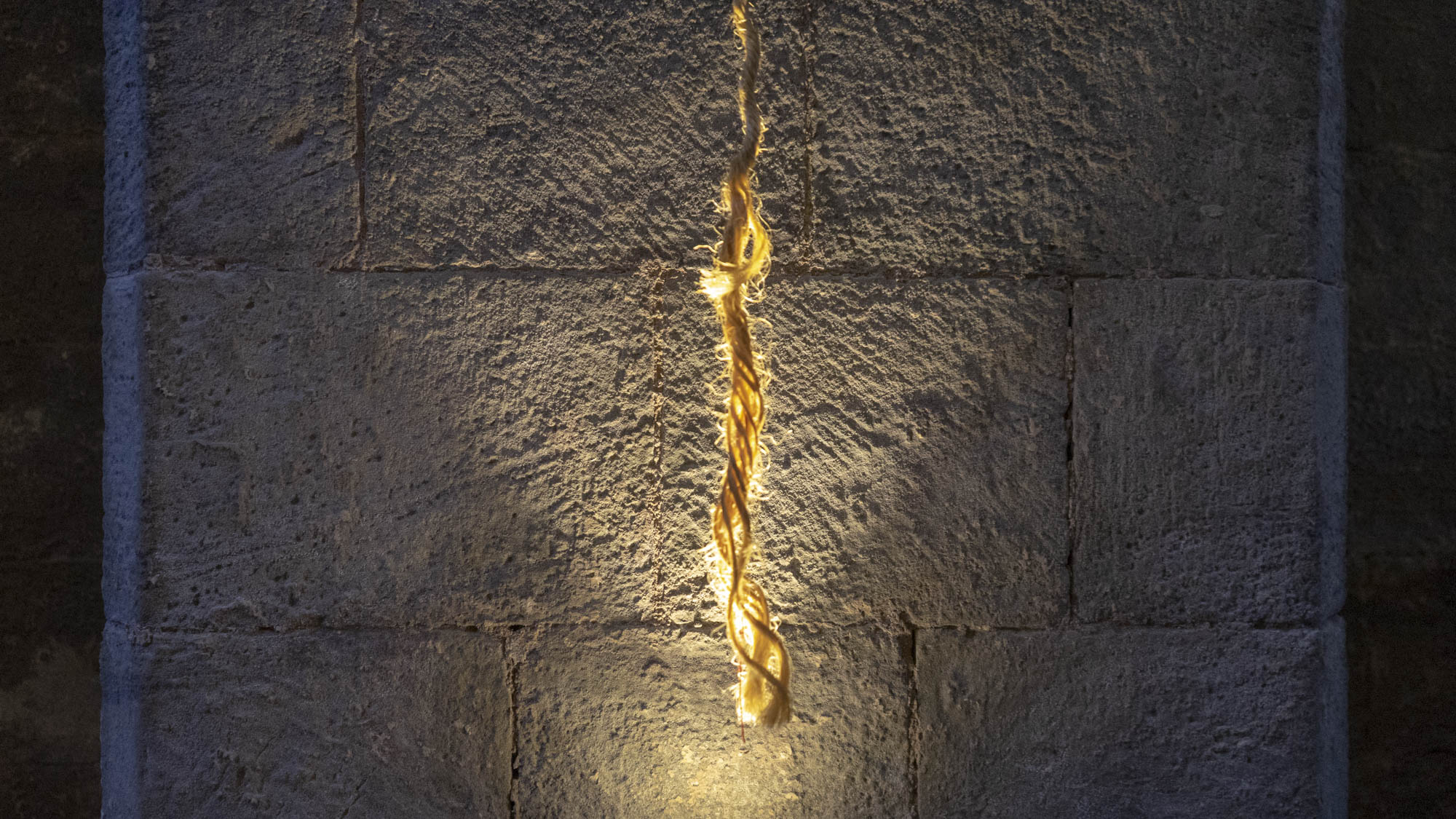
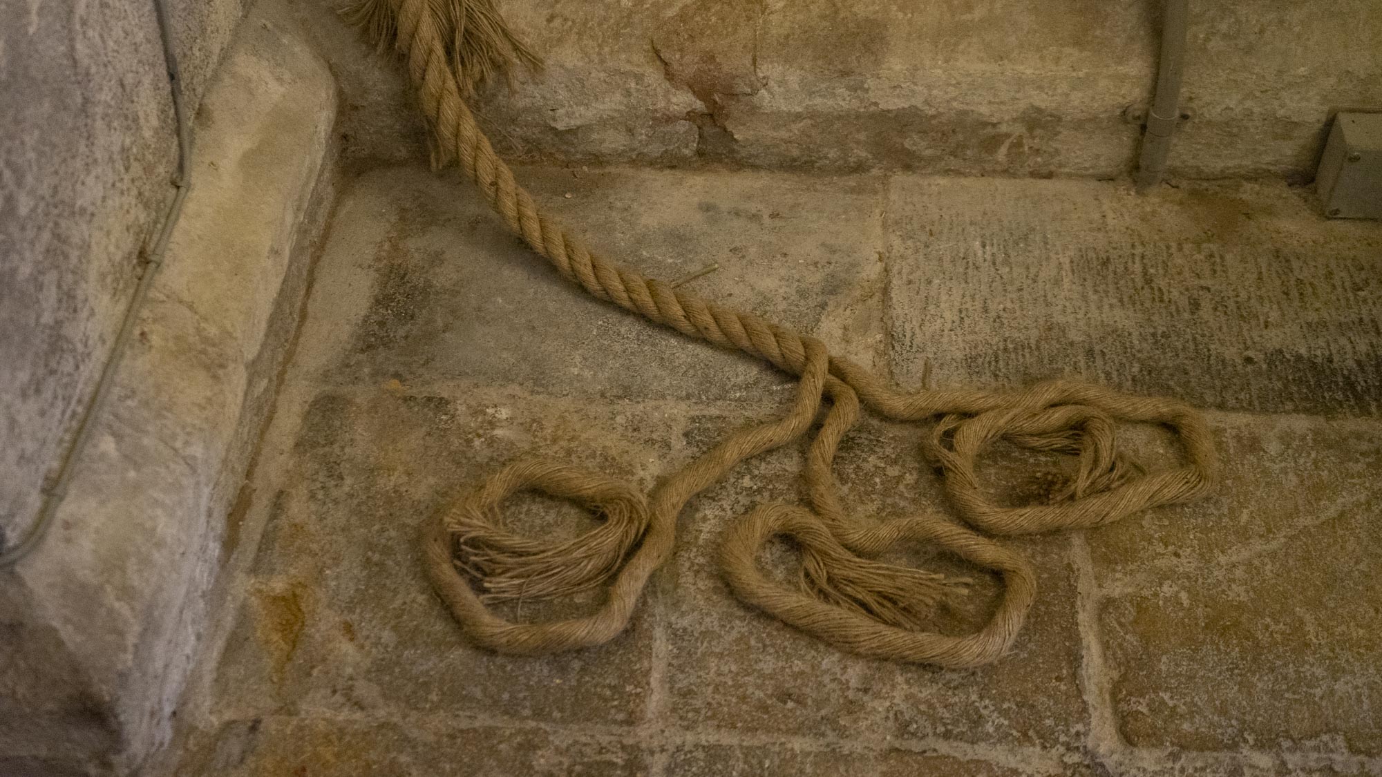
9. ‘Hanging Rope’
rope, ‘Measured to the Saint’ – artist’s length
10. ‘Re-Newport & Cardiff’
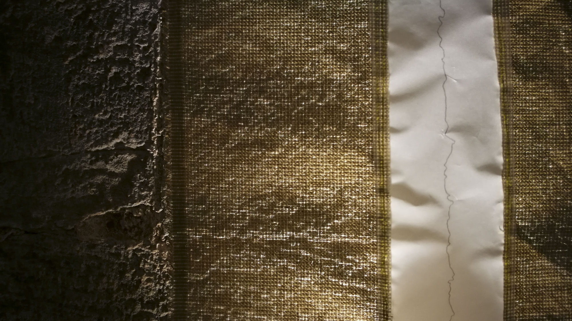
paper map pieces, gesso, pigment, glue & gold leaf on canvas
Again, the gridlines on a map help us relate to where we find ourselves and how we see where we are. Newport and Cardiff have undergone multiple changes since medieval times – deconstructions, reconstructions, and endless reworkings and reroutings, which can be disorienting and confusing even for locals. This piece is an attempt to make sense of things from the disrupted, but still beautiful, terrain.
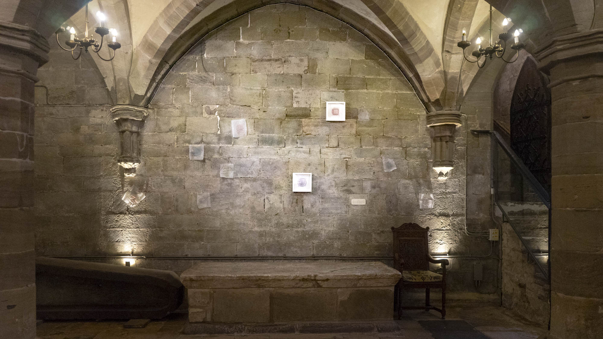
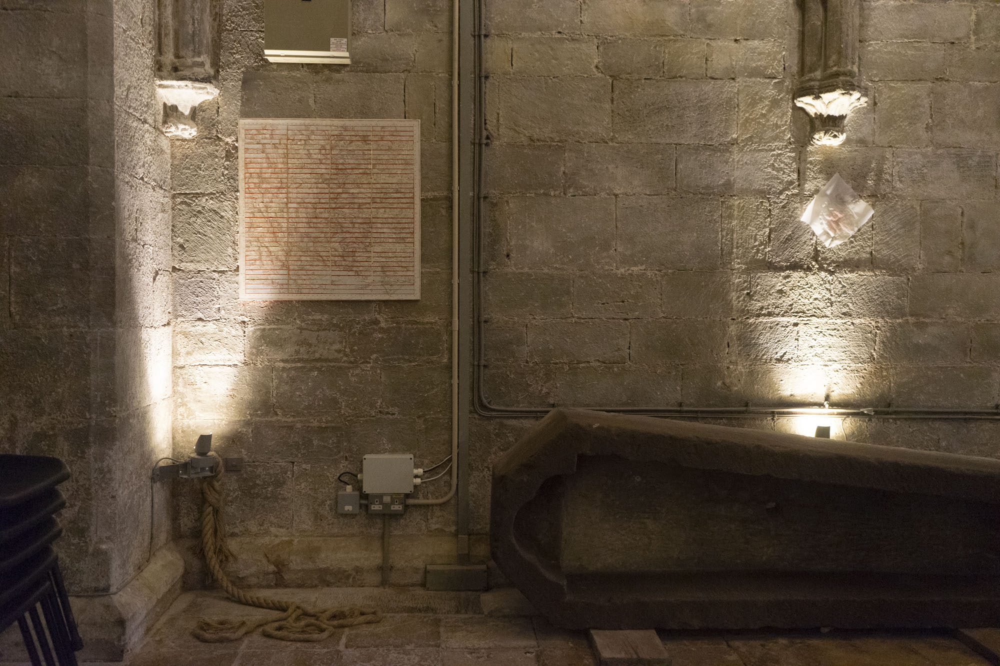
11. ‘Measuring: the Wall’
coloured cotton threads – artist’s length – on paper on medieval wall
Mapmaking changed the world towards the end of the medieval period, evolving from the strange and somewhat lyrical wolrd of the Mappa Mundi. During the Elizabethan ‘Age of Discovery’ journeys were measured and logged ‘scientifically’ by explorers. They became more and more geographically accurate. A map, even a digitally accurate one, is never entirely objective though – it’s just another way of looking. Here, the artist has accurately ‘Measured to the Saint’ herself over and over, but as you can see, the results are never identical or predictable. Make what you will of the wallscape created by the process…
Re-Making Maps of the Mind is a touring exhibition 2018-19 for the new St Thomas Way heritage trail – find out more online: thomasway.ac.uk.
This exhibition will tour locations along St Thomas Way throughout 2018-2019, returning to Hereford Cathedral in September 2019 for the 800th-anniversary celebrations of the canonisation of St Thomas Cantilupe.