
EXHIBITION: Re-Making Maps of the Mind: Medieval and Modern Journeys
at St Mary’s Priory Church, Abergavenny
Wednesday 15th August – Monday 3rd September 2018
“Measuring to the Saint”
St Thomas Way is a modern pilgrimage trail inspired by the medieval story of William Cragh. He was hung in Swansea in 1290, but miraculously came back to life. He was sure he’d been saved by Thomas, the late Bishop of Hereford and walked barefoot from Swansea to Hereford Cathedral to say ‘thank you’.
In those days, it was common practice to measure the bodies of the sick, needy or dead, by running a length of string or thread from the top of a person’s head to the tip of their toes. This length would be curled up and sent to the nearest cathedral or priory, where the monks would make it into a candle, light it, and then pray for the person’s eternal soul.
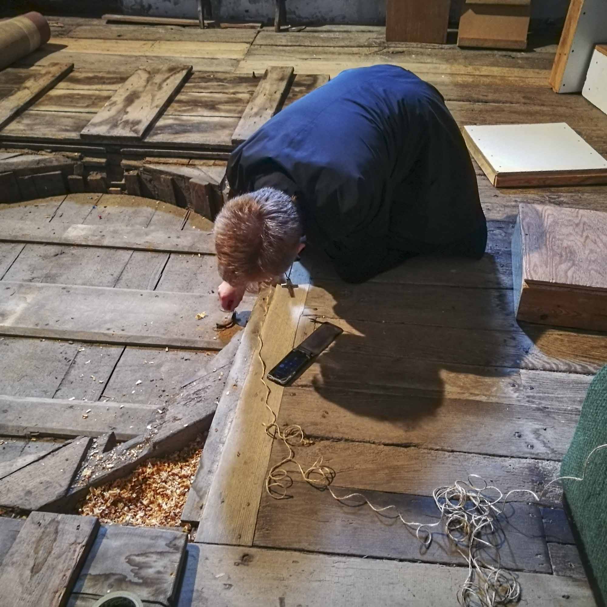
It was when he was being measured to the saint that William came back to life. The idea that something as humble as a simple piece of string might connect this world and the next, or be able to spark life into our very souls, inspired artist Michelle Rumney, to use the medieval practice of ‘Measuring to the Saint’ as a starting point to create this exhibition for the launch of St Thomas Way.
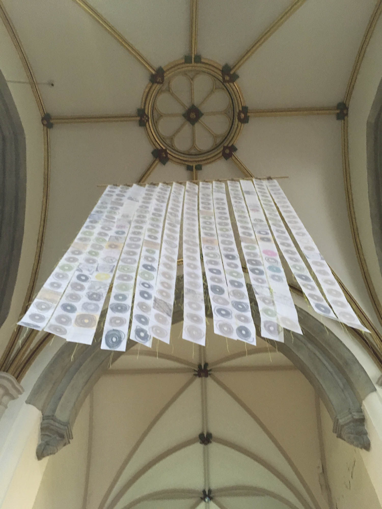

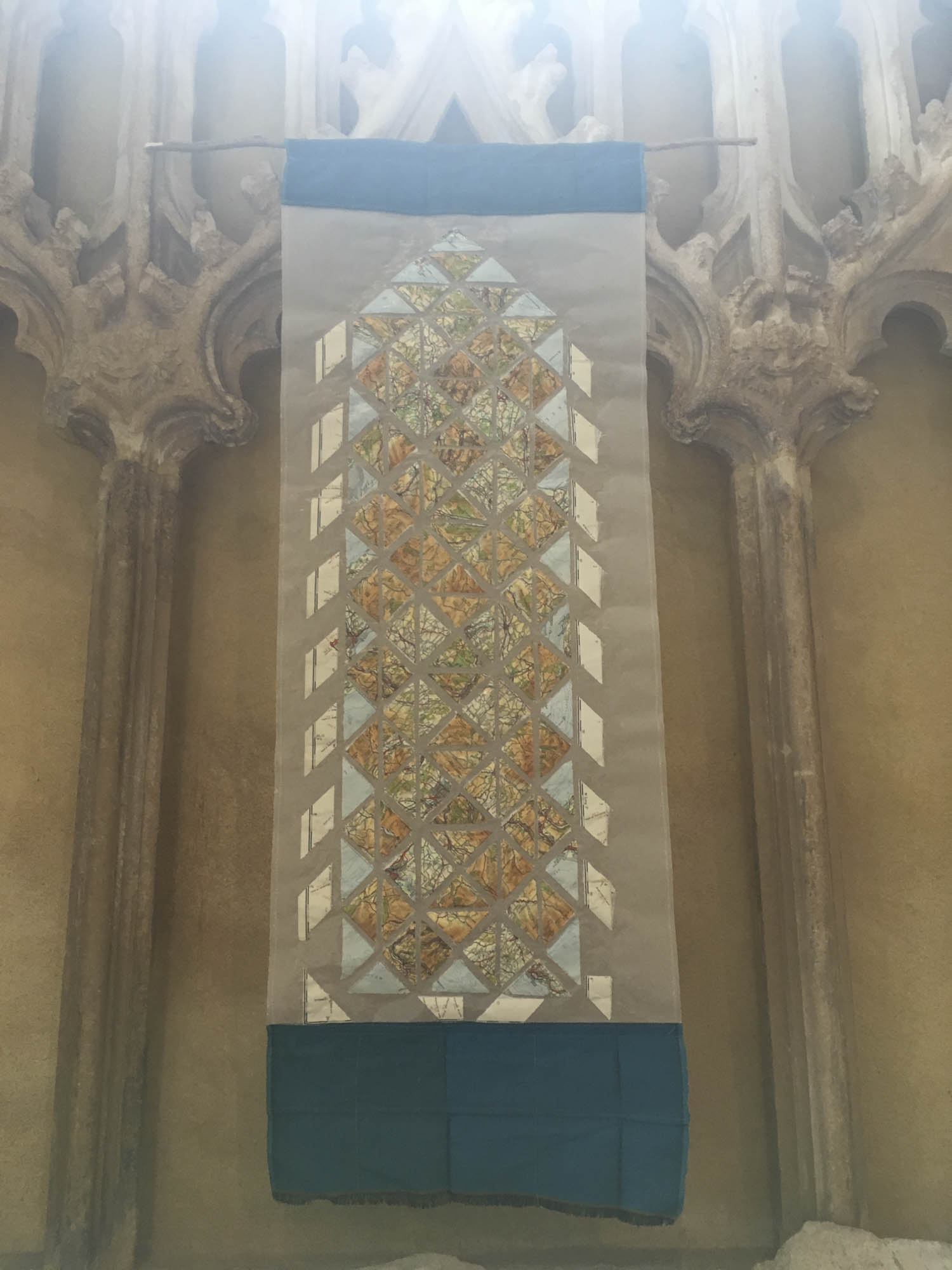
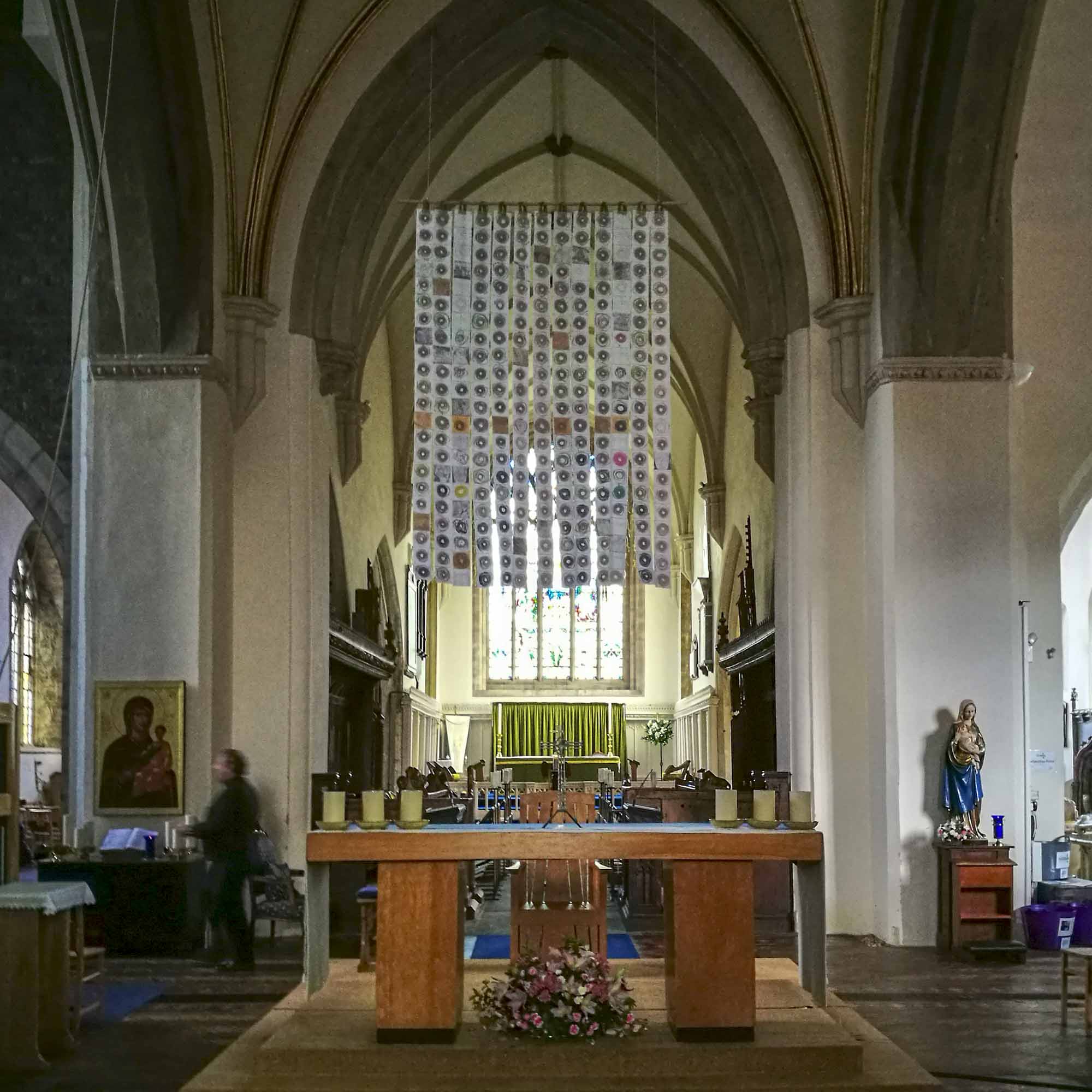
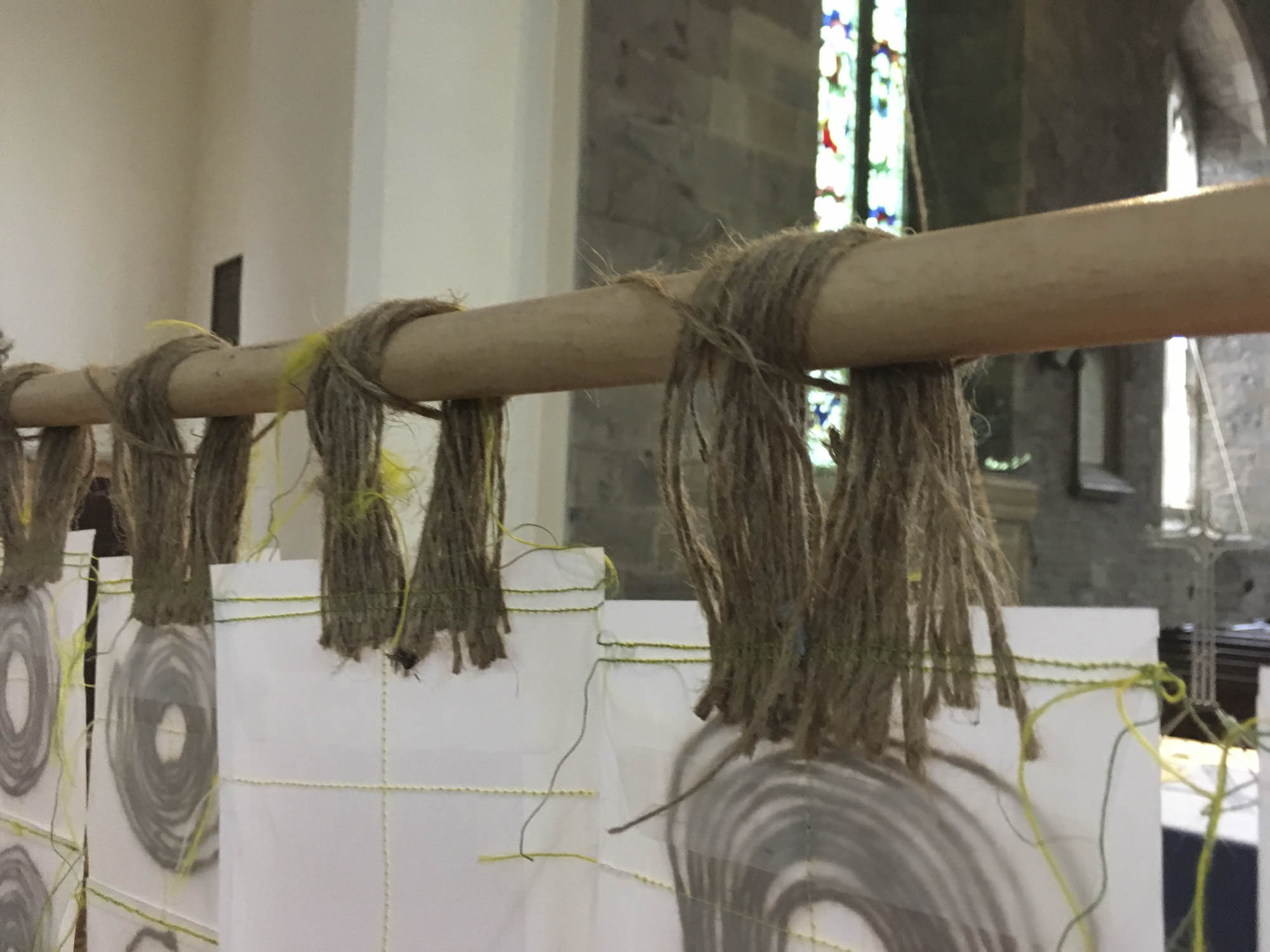
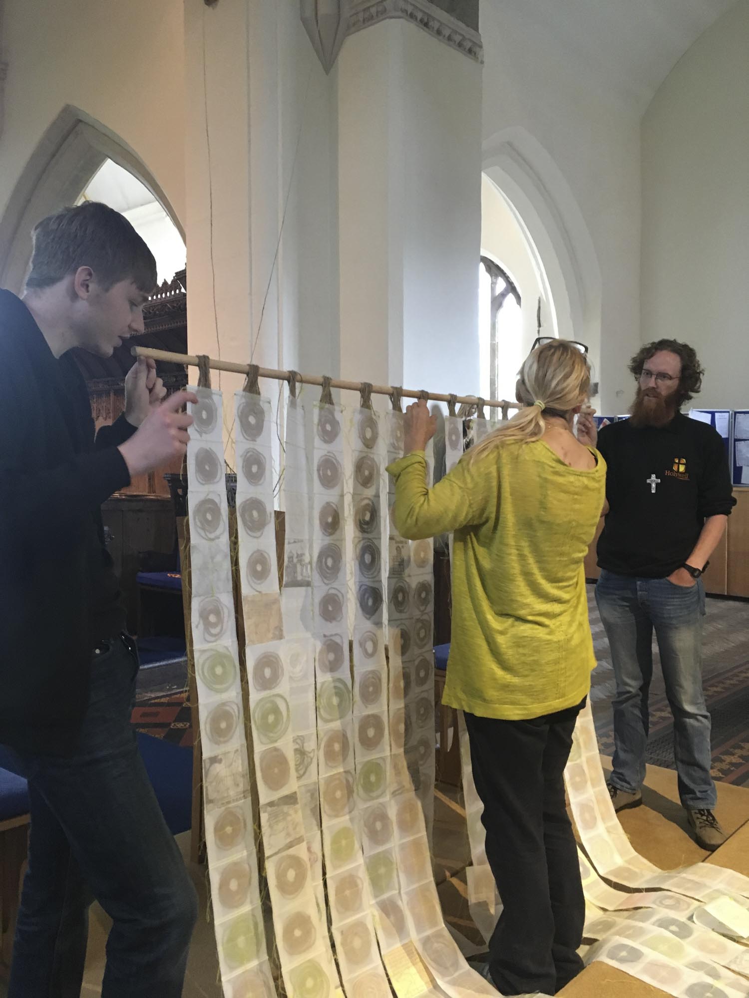
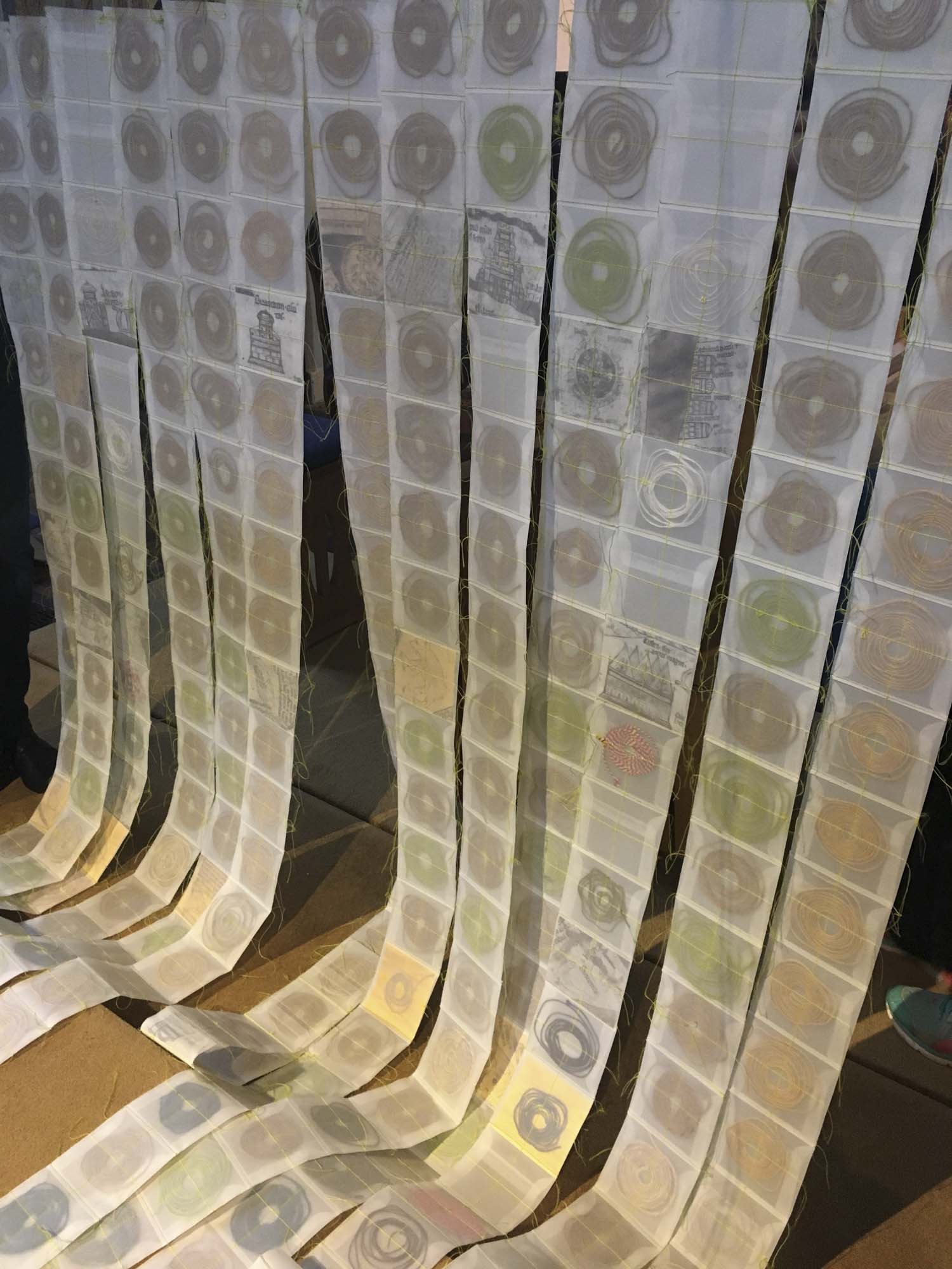
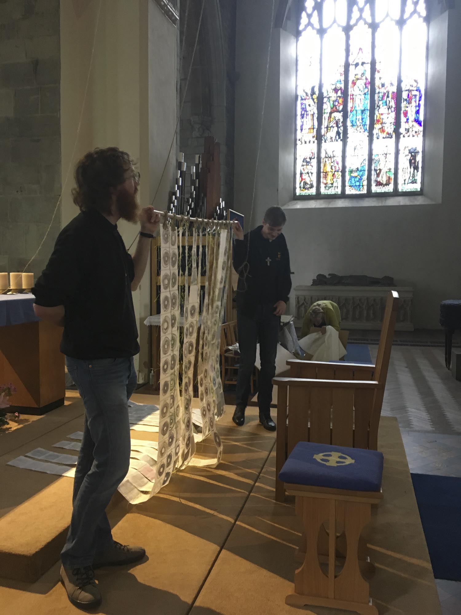
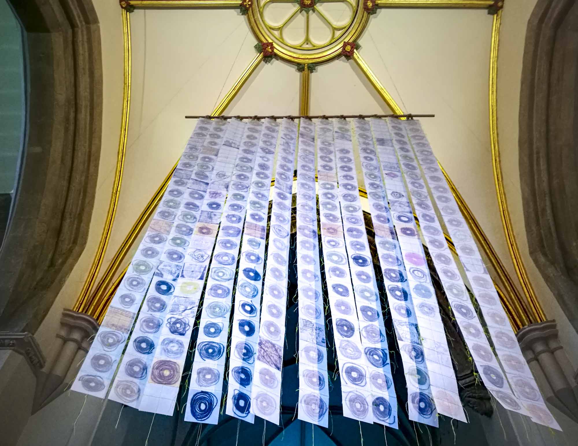
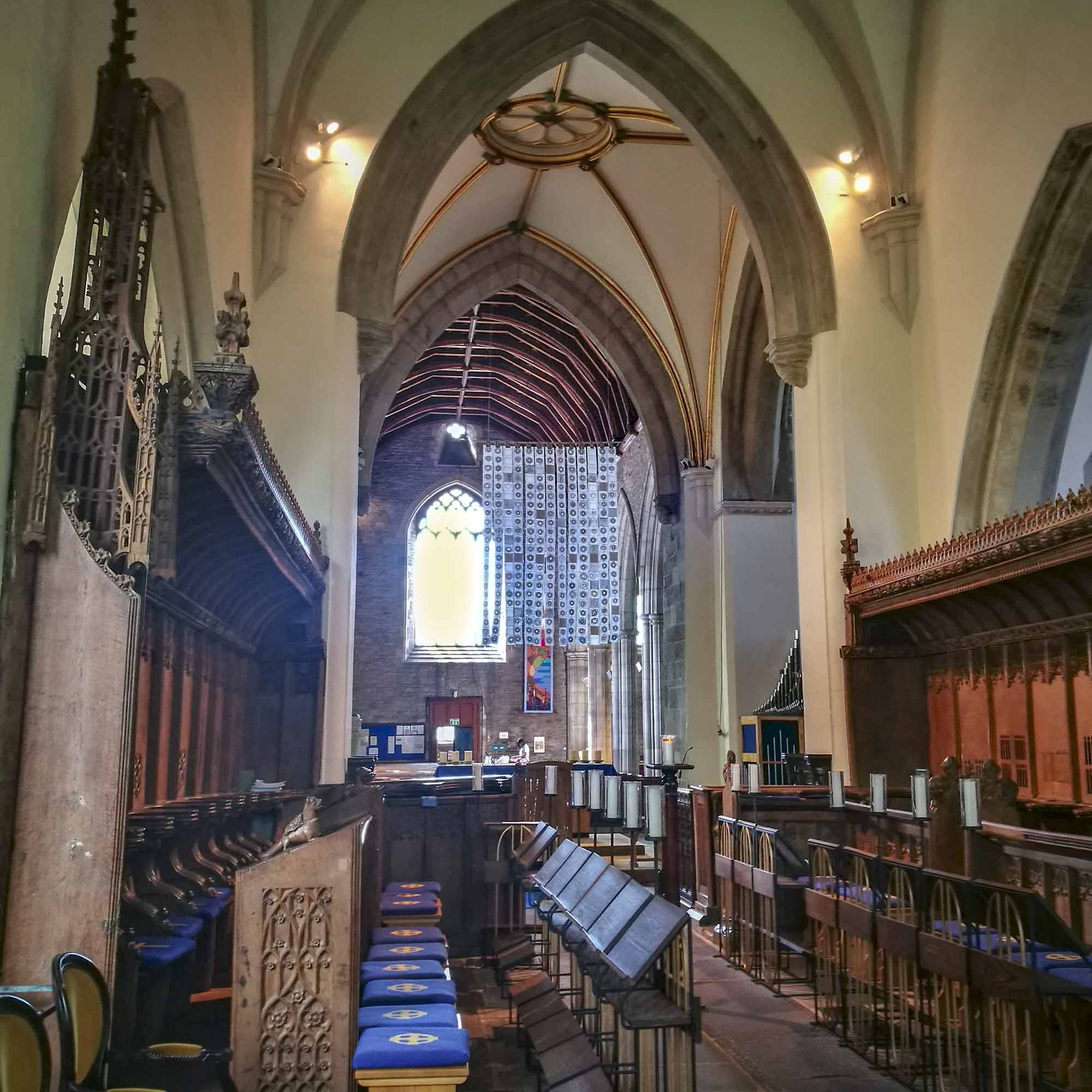
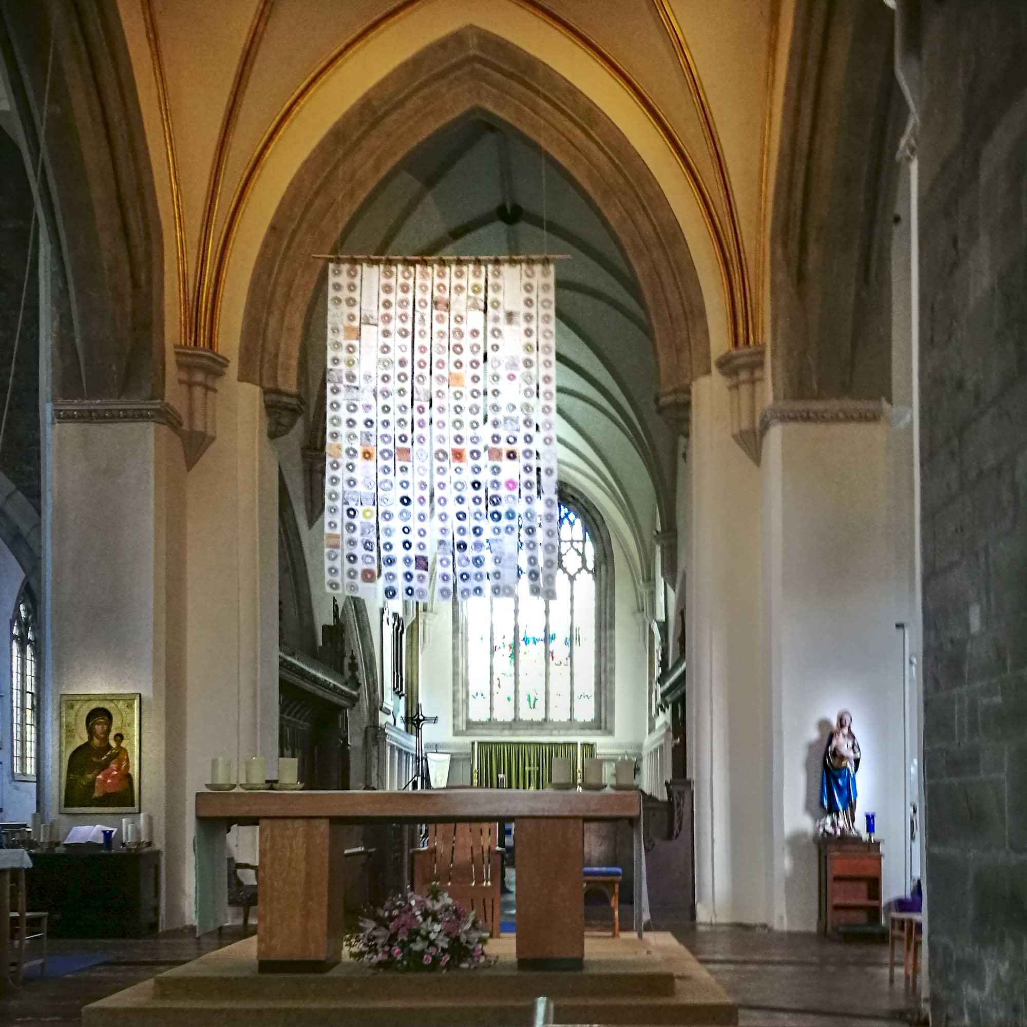
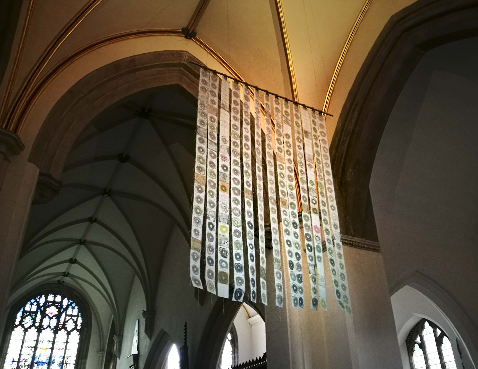
Hanging above the Altar: ‘The Map of Mundi’
Michelle used the medieval practice of ‘Measuring to the Saint’ to create this large artwork.
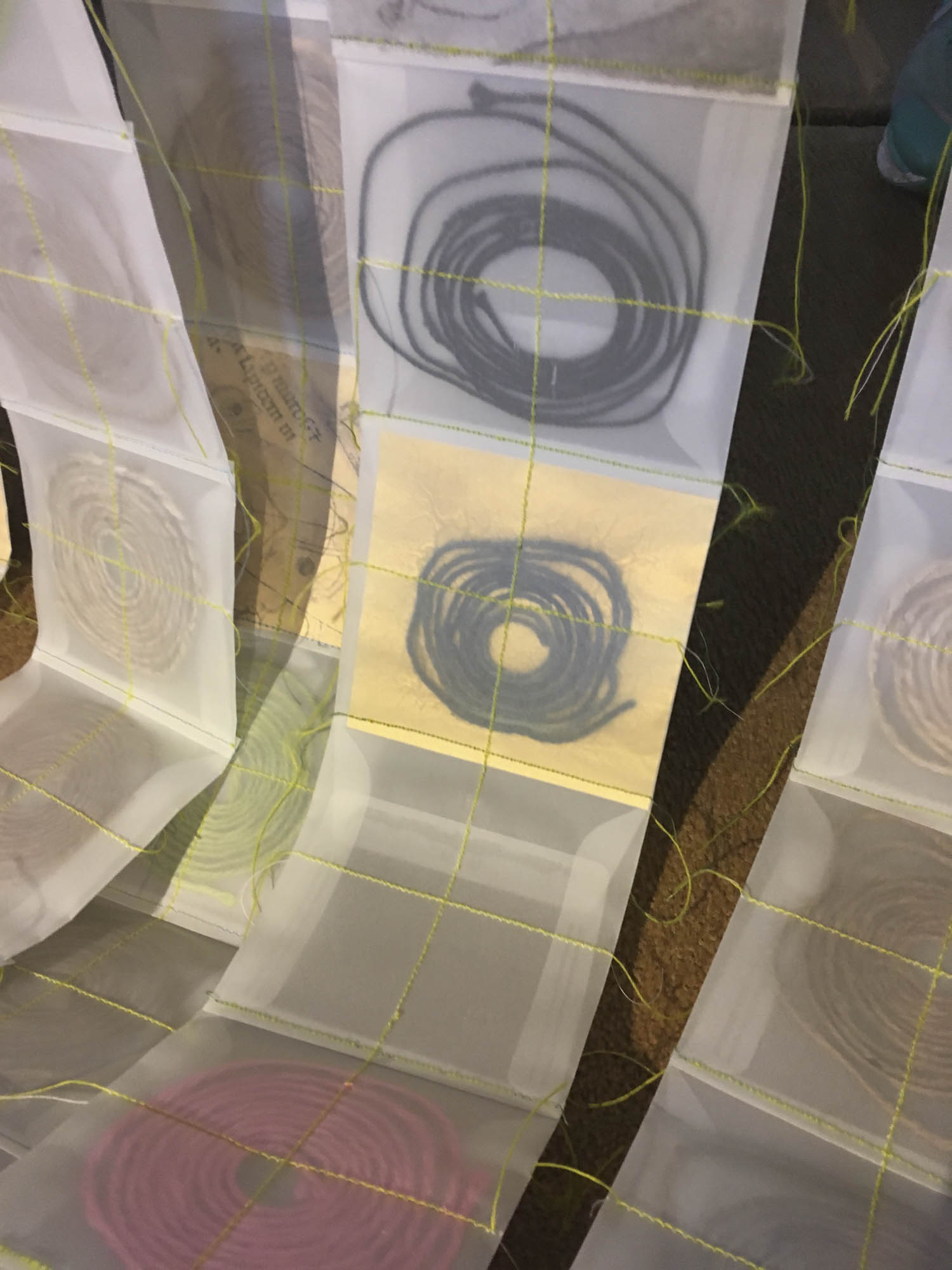
Telling the tale of William Cragh as she went, she measured over 250 people (and one great dane and a teddy bear) with string. In her studio she coiled each string into a spiral, She stitched a cross over each one, before stitching them together.
She also measured Hereford Cathedral’s Mappa Mundi, a wonderful account of how people saw the world – and has included a few people, places and animals from that too.
When they finally arrived at St Thomas’ shrine at Hereford Cathedral, pilgrims would stop beside the map and gaze at this fantastical world whilst guides would tell them stories about the characters and places in it, some from the Bible, and others, from myths and medieval folklore. This was part of the pilgrimage experience, widening their personal understanding of the world as they knew it…
“Change the way you look at things and the things you look at change…”
In this contemporary ‘Map of Mundi’ there are 13 vertical strips, one for each waypoint on St Thomas Way and in all, there are 286 squares.
Some squares have been left empty deliberately and the piece is transparent so that you can glimpse through into another time and space – both in this wonderful priory church and in your own imagination.
If you’ve travelled along any part of St Thomas Way – or are about to – take a moment now to pause with your fellow ‘pilgrims’ – the ones physically present in the spirals in this ‘map’ – and also with the thousands of people over the centuries who’ve been present right here where you are now on their own journey…
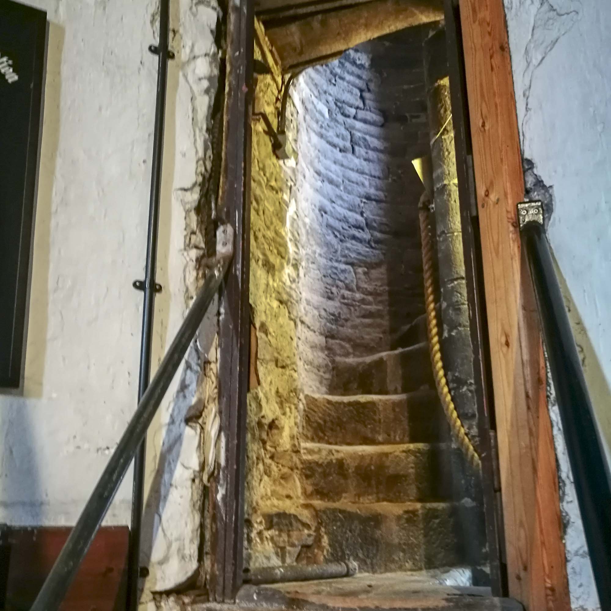
Exhibition Mini-pilgrimage in the Chapel
These artworks were created with the architecture of this quiet and contemplative space in mind, with opportunities to reflect from different perspectives. Moving clockwise from the red piece at the top of the steps:
1. ‘Mappa Mundi Threads’
hanging string, cardboard holes, bookcloth, & stitching on tracing paper
Look through the circular ‘windows’ and you’ll see a length of hanging string. This length of string is the diameter of the original Hereford Mappa Mundi, which has been “Measured to the Saint’. So, in another sense or at another scale, it could map the diameter of the world, or the distance between the poles…
What could it measure in your world?
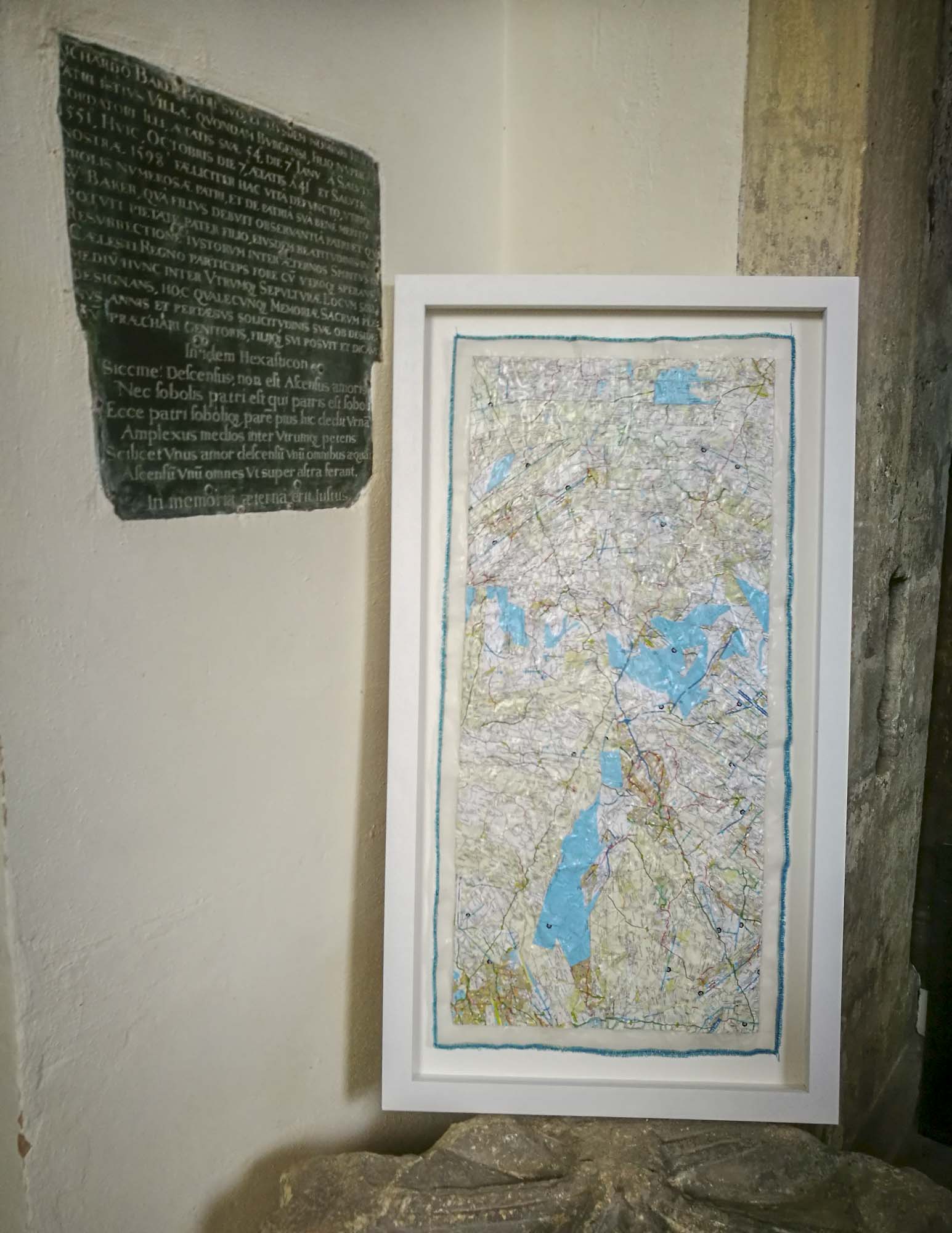
2. ‘From Me to You’
map pieces, glue & stitching on tracing paper
The line on this map is made from a road atlas and shows a route the artist has travelled many times – from her home in Dorset to the home of one of her dearest friends in Hereford. The route travels up Zig-Zag Hill near Shaftesbury, around Bristol, across the Severn Bridge and along the Wye Valley past Tintern Abbey. The journey usually takes about 4 hours. The map takes the form of a cross or kiss and forms its own new landscapes.
3. ‘Spiral – Measuring to the Saint’
coloured cotton thread – artist’s length – on paper
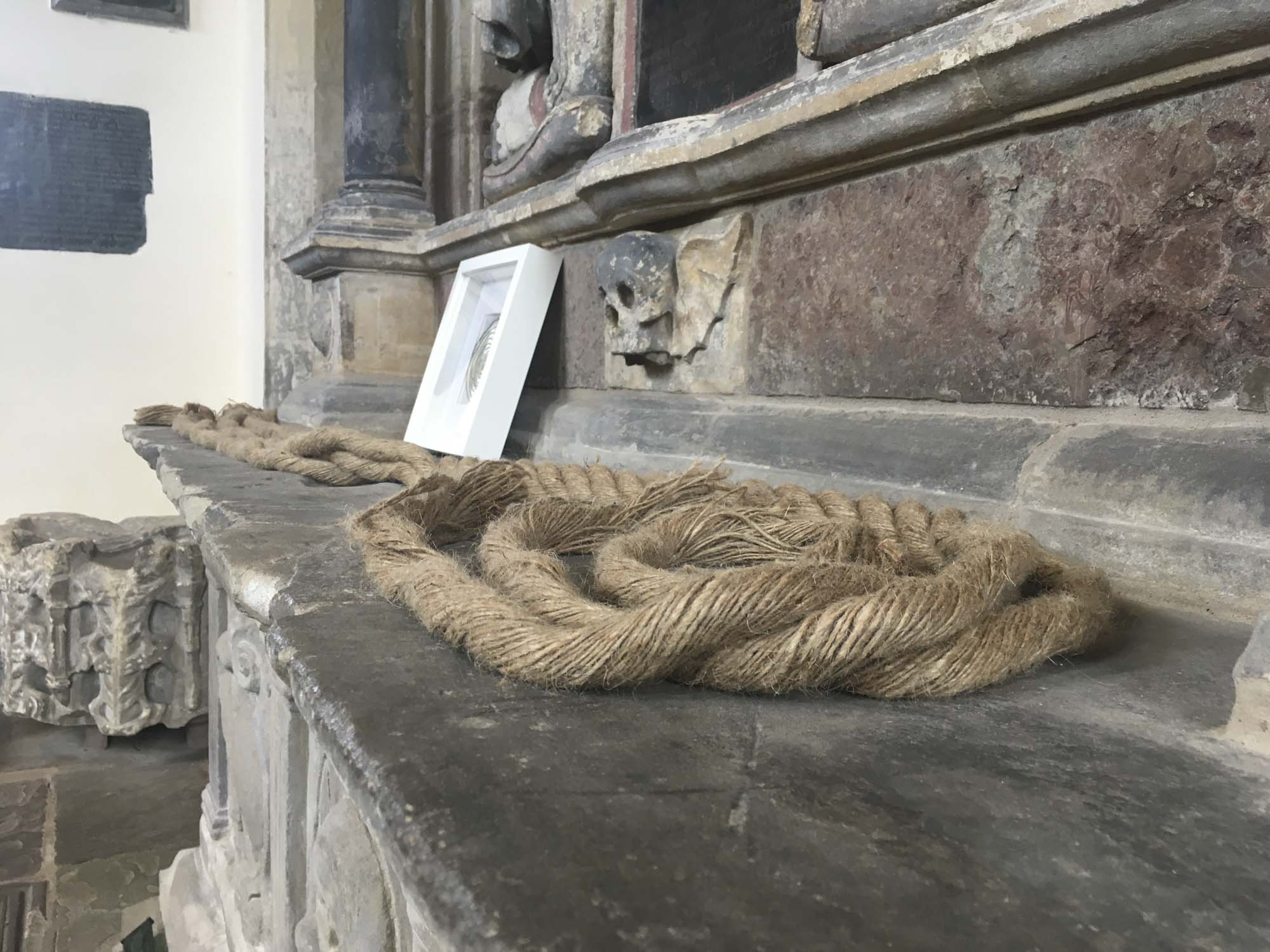
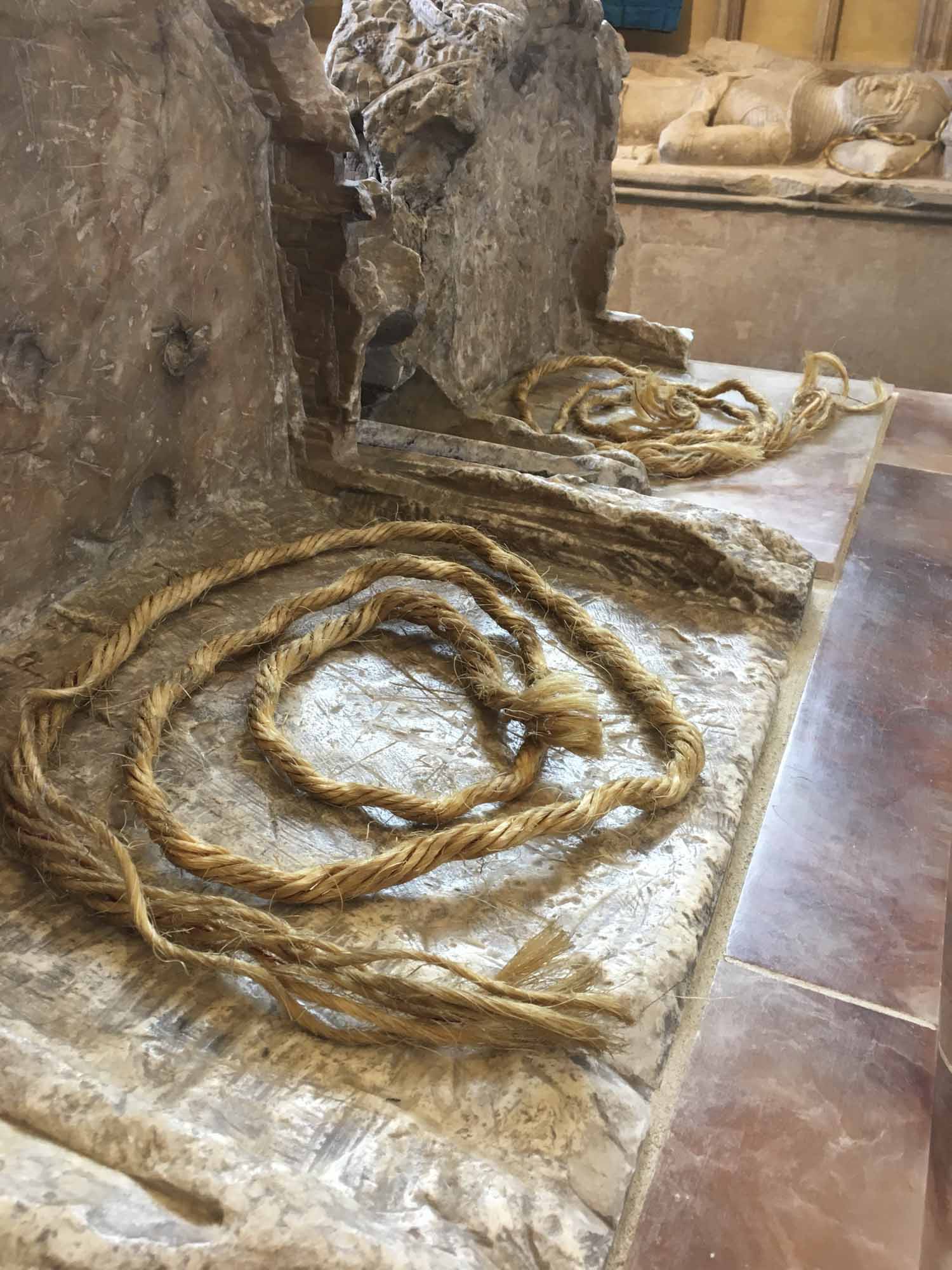
4. ‘Hanging Rope’
thick rope, ‘Measured to the Saint’ – artist’s length
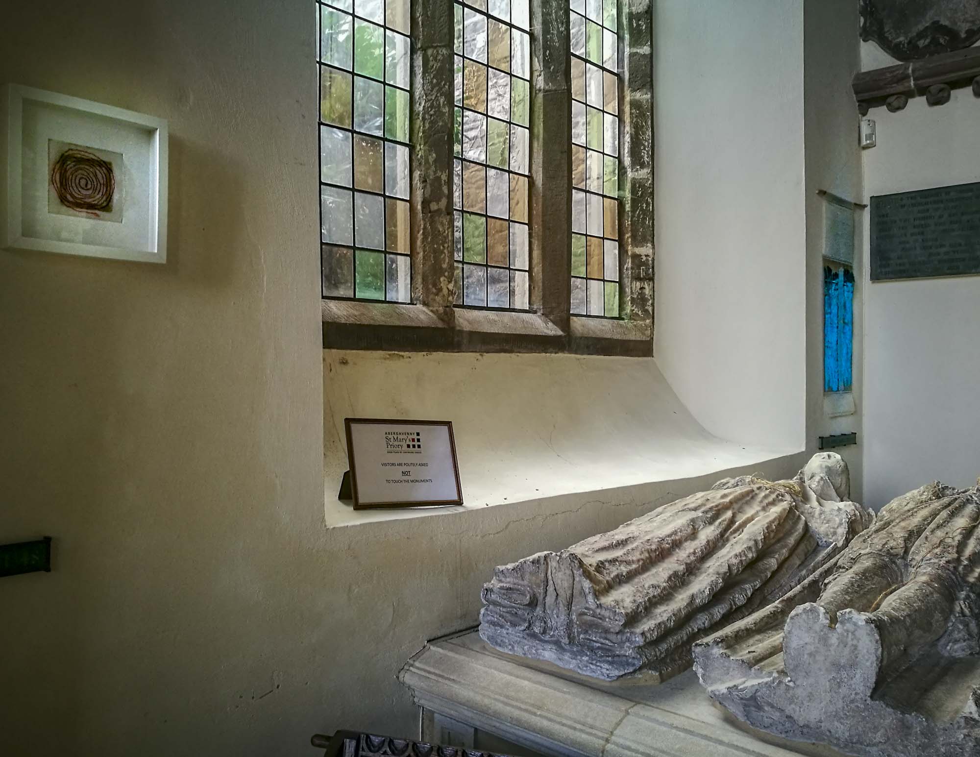
Notice that there are also lengths of string on some of the tombs in this chapel – they have also been Measured to the Saint, and a prayer said for them.


5. ‘St Thomas Way Traces’
pencil on tracing paper & stitching on tapestry guaze
This single pencil line is a tracing of the St Thomas Way strip map on the other side of the room (the one on black). Presented like this, it could represent many things: a trail that leads through many centuries; a journey across an invisible border between England and Wales; and the actual pilgrimage route that would be 74 miles as the crow flies, but is much, much longer if travelling on foot as William Cragh did, especially as he was also wearing a hangman’s noose around his neck…
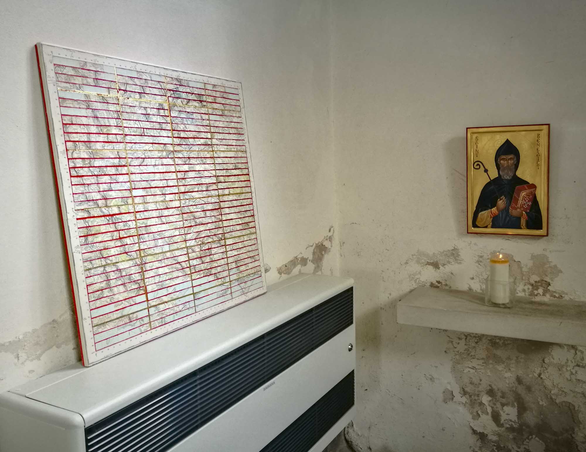
6. ‘Re-Newport & Cardiff’
paper map pieces, gesso, pigment, glue & gold leaf on canvas
Gridlines on a map help us relate to where we find ourselves and how we see where we are. Newport and Cardiff have undergone multiple changes since medieval times – decontructions, reconstructions, and endless reworkings and reroutings, which can be disorienting and confusing even for locals. This piece is an attempt to make sense of things from the disrupted, but still beautiful, terrain.
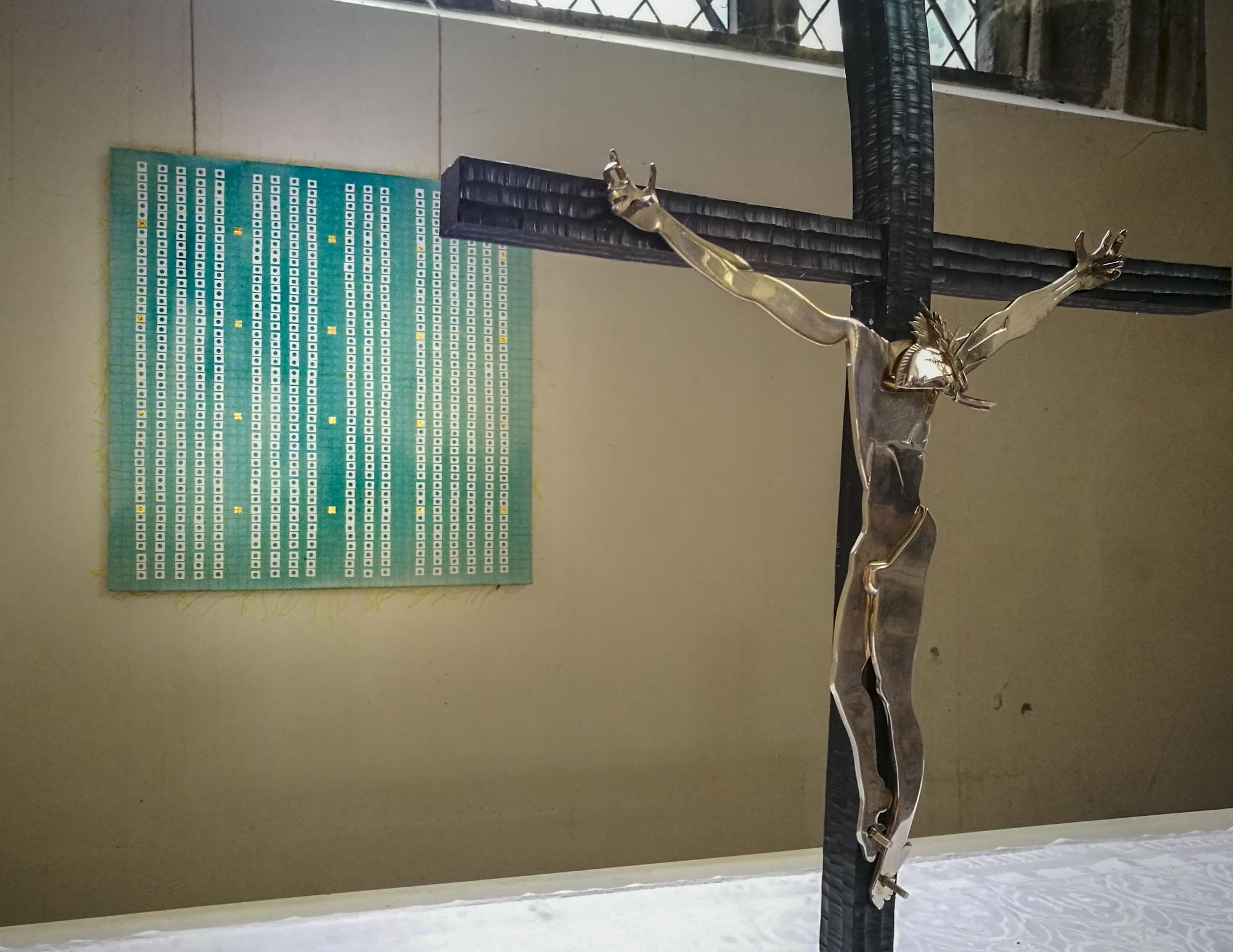
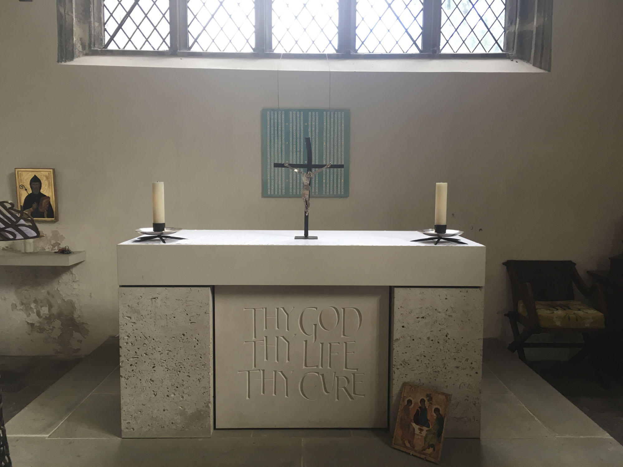
7. ‘There is no Away’ (behind the altar)
thread, paper perforations, pigment, gesso & gold leaf on canvas
Maps help us make sense of where we are in relation to the rest of the world and to ourselves. These gridlines or coordinates are punctuated by empty circles – made from the perforated holes at the top of an artists sketchbook. These holes are the bits you’d normally throw ‘away’, yet the things we discard all still exist in some form somewhere – and there is no ‘away’.
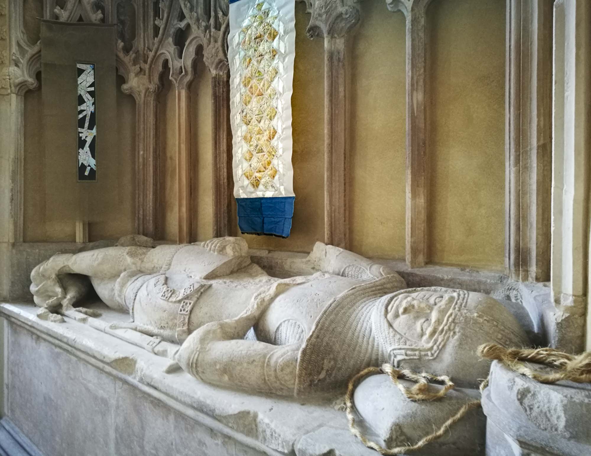
8. ‘Strip Map: St Thomas Way’
map pieces & stitching on paper on tapestry gauze
In the 17th Century, mapmakers like John Ogilby made maps for journeys helping travellers get from A to B. These ‘strip maps’ showed the route as a straight line, rather like Google Maps does on our mobile devices now. This strip map is the route of St Thomas Way, made from paper maps – never quite a straight line, but all the more interesting for it.
9. ‘Window Map’
map pieces & glue on tracing paper
Triangulation is an important map-making tool, invented in 1533 by Gemma Frisius, which emerged from Islamic mathematical ideas of the High Middle Ages. Using triangular pieces of a map of South Wales, this map shows many of the places on or around the St Thomas Way. Which new connections can you make between these familiar and unfamiliar places?
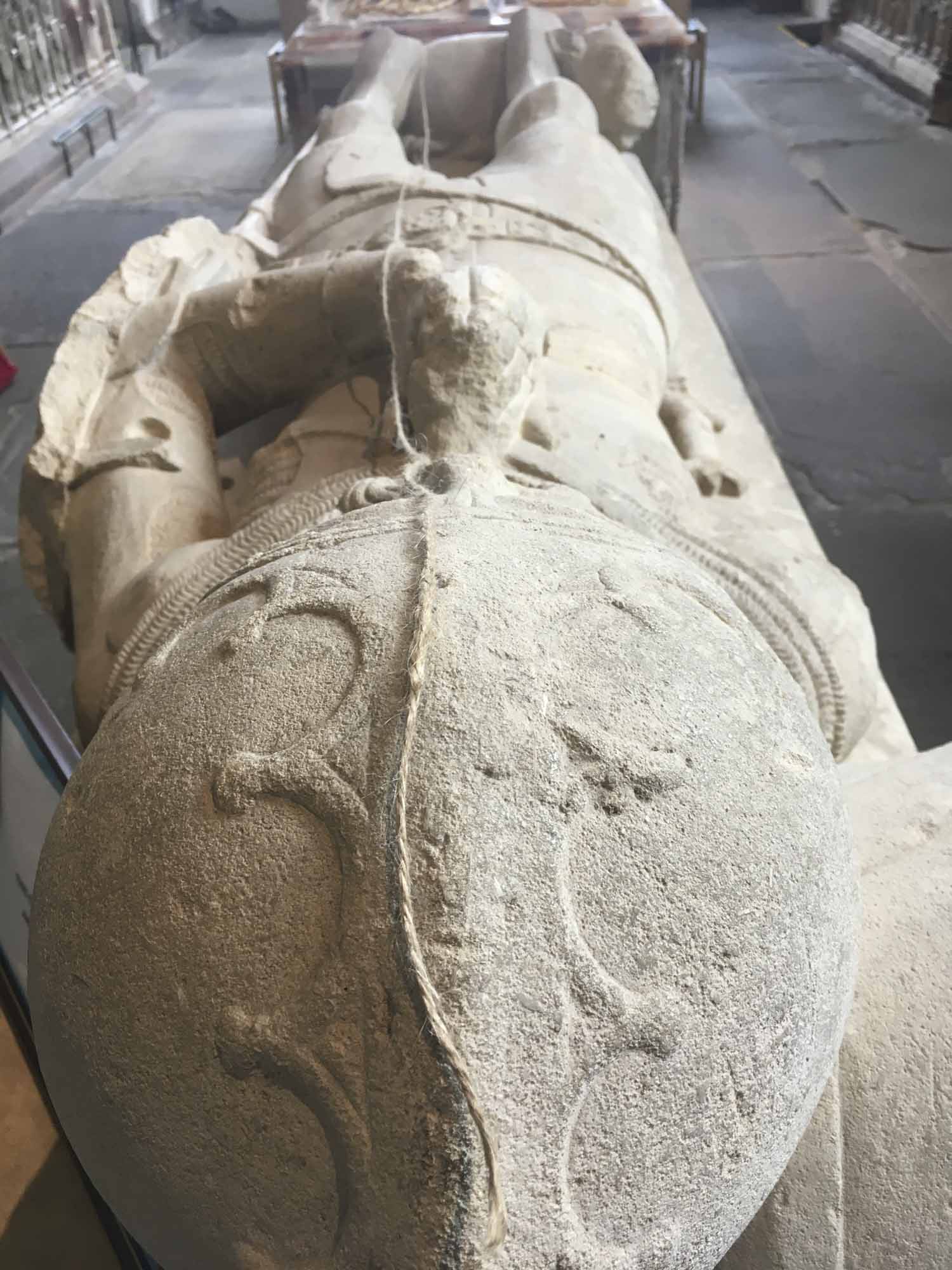
10. ‘From You to Me’
two ropes, curled at the head of the tomb in the centre of the chapel
These two strands cut from the same rope are identical in length – the length of the artist when ‘Measured to the Saint’. The lines they each take are not nearly the same, and they are separate, but there are many connections between them. Can two people’s journeys ever really be the same?
11. ‘Spiral – Measuring to the Saint’
coloured cotton thread – artist’s length – on paper
Notice that there are also lengths of string on some of the tombs in this chapel – they have also been Measured to the Saint, and a prayer said for them.
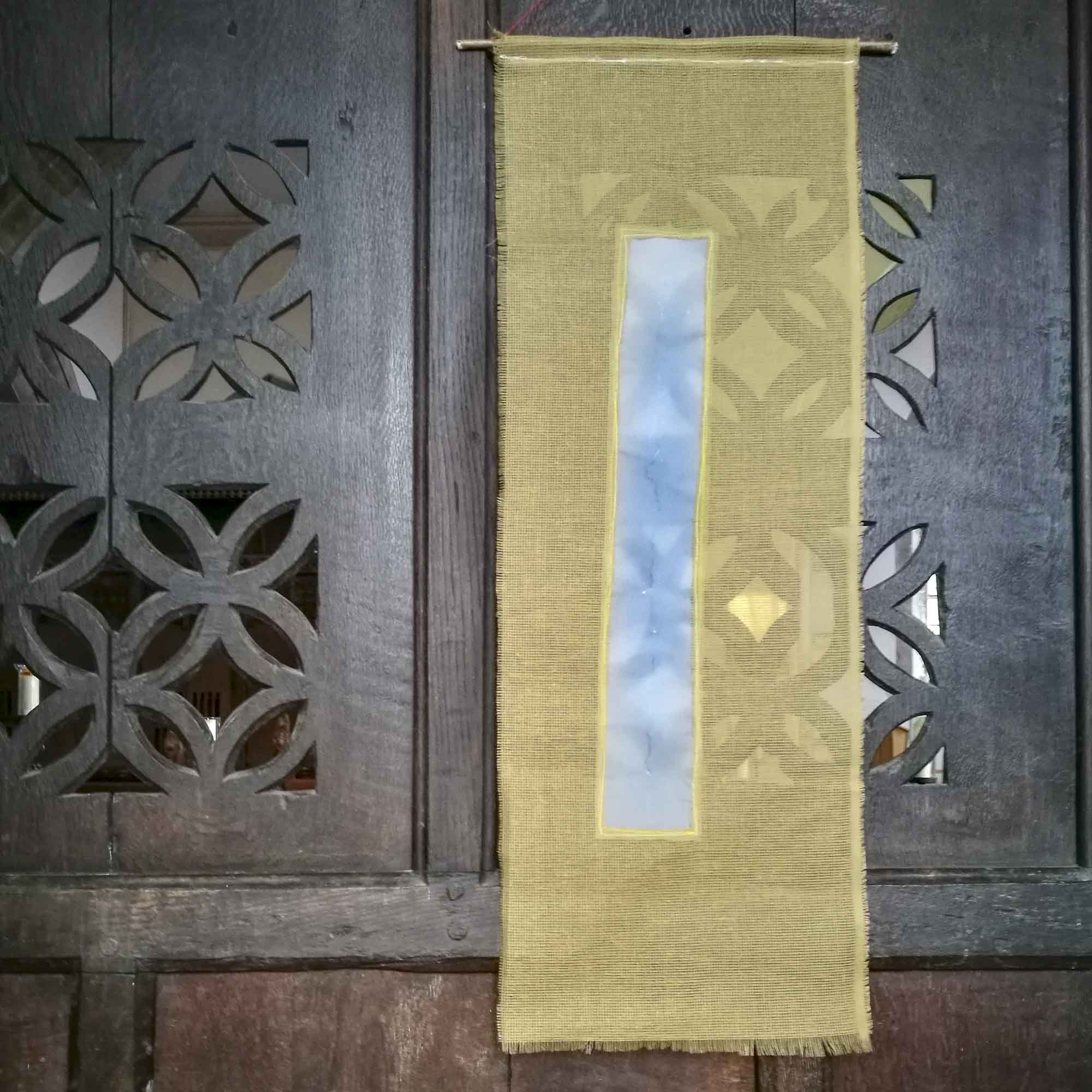
12. ‘Light Map’
blue coloured foil, pencil, stitching & silk on tracing paper
Like piece 5., this is traced from the original strip map, (piece 8). This time, the route crosses a blue ‘landscape’ and creates ripples or contours of its own. In this chapel, full of light, it reflects everything around it, and changes constantly as the light of the day progresses.
Now pause for a moment and close your eyes. Listen. Absorb something of this wonderful place, before moving on with your day…
EXHIBITION-ON-TOUR: Re-Making Maps of the MindMedieval and Modern Journeys
The St Thomas Way exhibition is on the move itself, travelling during 2018 – 2019 to different places along the trail.
Each time the exhibition moves to a new place, the way the artworks present themselves changes too.
Here in the light-filled chapel of St Mary’s, the artworks look and feel very different than they did in the crypt of Hereford Cathedral, which was the first stop on the exhibition trail.
To follow the exhibition as it moves, and see how it changes, please join Michelle’s mailing list.
The next stop on the exhibition’s pilgrimage is:
On Tour next to… St Mary’s in Swansea
Tuesday 4th September – Saturday 6th October
Please join us there too!
Find out more about the trail online: